- Cecil County
-
Verwaltung US-Bundesstaat: Maryland Verwaltungssitz: Elkton Adresse des
Verwaltungssitzes:County Administrative Building
200 Chesapeake Blvd.
Elkton, MD 21921Gründung: 1674 Gebildet aus: Baltimore und Kent County Vorwahl: 001 410 Demographie Einwohner: 101.108 (2010) Bevölkerungsdichte: 112,2 Einwohner/km² Geographie Fläche gesamt: 1.082 km² Wasserfläche: 181 km² Karte 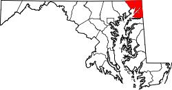
Website: www.ccgov.org Das Cecil County[2] ist ein County im Bundesstaat Maryland der Vereinigten Staaten von Amerika. Bei der Volkszählung im Jahr 2010 hatte das County 101.108 Einwohner und eine Bevölkerungsdichte von 112,2 Einwohnern pro Quadratkilometer. Der Verwaltungssitz (County Seat) ist Elkton.
Das Cecil County ist Bestandteil der Delaware Valley genannten Metropolregion um die Stadt Philadelphia.
Inhaltsverzeichnis
Geografie
Das County wird im Norden durch die Mason-Dixon-Linie von Pennsylvania getrennt; östlich grenzt das County an Delaware. Das Cecil County liegt an der Mündung des Susquehanna River in die Chesapeake Bay und hat eine Fläche von 1.082 Quadratkilometern. Davon sind 181 Quadratkilometer (16,69 Prozent) Wasserflächen. Es grenzt an folgende Countys:
Lancaster County
(Pennsylvania)Chester County
(Pennsylvania)Harford County 
New Castle County
(Delaware)Kent County Geschichte
 Cecilius Calvert
Das Cecil County wurde 1674 aus Teilen des Baltimore und des Kent Countys gebildet. Benannt wurde es nach dem Vornamen von Cecilius Calvert, 1. Baron Baltimore (1605-1675), dem ersten Lord Proprietor der damaligen englischen Kolonie Maryland.
Demografische Daten
Historische Einwohnerzahlen Census Einwohner ± in % 1790 13.625 — 1800 9018 -30 % 1810 13.066 40 % 1820 16.048 20 % 1830 15.432 -4 % 1840 17.232 10 % 1850 18.939 10 % 1860 23.862 30 % 1870 25.874 8 % 1880 27.108 5 % 1890 25.851 -5 % 1900 24.662 -5 % 1910 23.759 -4 % 1920 23.612 -0,6 % 1930 25.827 9 % 1940 26.407 2 % 1950 33.356 30 % 1960 48.408 50 % 1970 53.291 10 % 1980 60.430 10 % 1990 71.347 20 % 2000 85.951 20 % 2010 101.108 20 % vor 1900[3] 1900–1990[4] 2000[5] 2010[6] Nach der Volkszählung im Jahr 2000 lebten im Cecil County 85.951 Menschen in 31.223 Haushalten und 23.292 Familien. Die Bevölkerungsdichte betrug 247 Personen pro Quadratkilometer. Ethnisch betrachtet setzte sich die Bevölkerung zusammen aus 93,4 Prozent Weißen, 3,9 Prozent Afroamerikanern, 0,3 Prozent amerikanischen Ureinwohnern, 0,7 Prozent Asiaten und 0,5 Prozent aus anderen ethnischen Gruppen; 1,2 Prozent stammten von zwei oder mehr Ethnien ab. Unabhängig von der ethnischen Zugehörigkeit waren 1,5 Prozent der Bevölkerung spanischer oder lateinamerikanischer Abstammung.
Von den 31.223 Haushalten hatten 37,0 Prozent Kinder unter 18 Jahren, die mit ihnen lebten. 58,6 Prozent waren verheiratete, zusammenlebende Paare, 11,1 Prozent waren allein erziehende Mütter und 25,4 Prozent waren keine Familien. 19,9 Prozent aller Haushalte waren Singlehaushalte und in 7,1 Prozent lebten Menschen im Alter von 65 Jahren oder darüber. Die durchschnittliche Haushaltsgröße lag bei 2,71 und die durchschnittliche Familiengröße bei 3,12 Personen.
27,7 Prozent der Bevölkerung war unter 18 Jahre alt, 7,5 Prozent zwischen 18 und 24, 31,2 Prozent zwischen 25 und 44, 23,2 Prozent zwischen 45 und 64 Jahre alt und 10,5 Prozent waren 65 Jahre oder älter. Das Durchschnittsalter betrug 36 Jahre. Auf 100 weibliche kamen statistisch 98,2 männliche Personen und auf 100 Frauen im Alter von 18 Jahren oder darüber kamen 95,7 Männer.
Das durchschnittliche Einkommen eines Haushaltes betrug 50.510 USD, das einer Familie 56.469 USD. Männer hatten ein durchschnittliches Einkommen von 40.350 USD, Frauen 28.646 USD. Das Pro-Kopf-Einkommen lag bei 21.384 USD. Etwa 5,4 Prozent der Familien und 7,2 Prozent der Bevölkerung lebten unterhalb der Armutsgrenze.[7]
Städte und Gemeinden
- Cecilton
- Charlestown
- Chesapeake City
- Elkton
- North East
- Perryville
- Port Deposit
- Rising Sun
- Calvert
- Carpenter Point
- Childs
- Colora
- Conowingo
- Earleville
- Elk Mills
- Elk Neck
- Fair Hill
- Georgetown
- Perry Point
- Red Point
- Warwick
- White Crystal Beach
Einzelnachweise
- ↑ Auszug aus dem National Register of Historic Places Abgerufen am 13. März 2011
- ↑ GNIS-ID: 596115. Abgerufen am 22. Februar 2011 (englisch).
- ↑ University of Virginia Library - Historical Census Browser Abgerufen am 1. Juli 2011
- ↑ United States Census.gov Abgerufen am 1. Juli 2011
- ↑ U.S. Census Buero - United States Census 2000 für das Cecil County Abgerufen am 1. Juli 2011
- ↑ United States Census 2010 Abgerufen am 1. Juli 2011
- ↑ Cecil County, Maryland Datenblatt mit den Ergebnissen der Volkszählung im Jahre 2000 bei factfinder.census.gov
Weblinks
-
 Commons: Cecil County, Maryland – Sammlung von Bildern, Videos und Audiodateien
 - Offizielle Webseite
- Cecil County Tourism - Office of Economic Development
- Maryland State Archives - Cecil County
- www.city-data.com

Liste der Countys in Maryland
Allegany | Anne Arundel | Baltimore City | Baltimore | Calvert | Caroline | Carroll | Cecil | Charles | Dorchester | Frederick | Garrett | Harford | Howard | Kent | Montgomery | Prince George’s | Queen Anne’s | Saint Mary's | Somerset | Talbot | Washington | Wicomico | Worcester
Wikimedia Foundation.
Schlagen Sie auch in anderen Wörterbüchern nach:
Cecil County — Admin ASC 2 Code Orig. name Cecil County Country and Admin Code US.MD.015 US … World countries Adminstrative division ASC I-II
Cecil County Public Schools — is a public school system serving the residents of Cecil County, Maryland.High schools* Bohemia Manor High School , Chesapeake City, MD * Elkton High School , Elkton, MD * North East High School , North East, MD * Perryville High School ,… … Wikipedia
Cecil County, Maryland — Infobox U.S. County county = Cecil County state = Maryland founded year = 1674 seat wl = Elkton | area total sq mi =418 area land sq mi =348 area water sq mi =70 area percentage = 16.69% census yr = 2007 pop = 99506 density km2 =95 web =… … Wikipedia
Cecil County Public Library — The Cecil County Public Library is a public library system in Cecil County, Maryland. Cecil County, located in the northeastern tip of Maryland, is one of the fastest growing counties in Maryland1.CCPL is experiencing significant growth. Since… … Wikipedia
Cecil County Sheriff's Office — The Cecil County Sheriff s Office (CCSO) is the primary law enforcement agency servicing a population of 99,506 people within 348.13 square miles of juridiction. [ [http://quickfacts.census.gov/qfd/states/24/24015.html Cecil County QuickFacts… … Wikipedia
Cecil County Circuit Courthouse — Infobox Historic building name = Cecil County Circuit Courthouse caption = map type = latitude = 39.610 longitude = 75.824 location = 129 E. Main Street location town = Elkton, Maryland location country = United states of America architect =… … Wikipedia
National Register of Historic Places listings in Cecil County, Maryland — Location of Cecil County in Maryland This is a list of the National Register of Historic Places listings in Cecil County, Maryland. This is intended to be a complete list of the properties and districts on the National Register of Historic Places … Wikipedia
Cecil — ist der Familienname folgender Personen: David Cecil (1905–1981), britischer Hochschullehrer und Schriftsteller David Cecil, 6. Marquess of Exeter (1905–1981), britischer Leichtathlet und Sportfunktionär Hugh Cecil, 1. Baron Quickswood… … Deutsch Wikipedia
Cecil — IPA| [ˈsɛs(ɪ)l, ˈsɛs(ə)l, ˈsɪs(ɪ)l] may refer to:Places in the United States of America:*Cecil, Georgia *Cecil, Ohio *Cecil, Pennsylvania *Cecil County, Maryland *Cecil, WisconsinCecil for peopleAs a given nameInfobox Given Name Revised name =… … Wikipedia
Cecil Township, Pennsylvania — Geobox|Township name = Cecil Township official name = category = Township image size = image caption = flag size = symbol = symbol size = etymology = Cecil County, Maryland etymology type = Named for nickname = motto = country = United States… … Wikipedia
Cecil County


18+
© Academic, 2000-2025
- Kontaktieren Sie uns: Unterstützung, Werbung
Wörterbücher Export, schritte mit PHP, Joomla, Drupal, WordPress, MODx.