- Allegany County (Maryland)
-
 Das Allegany County Courthouse in Cumberland
Verwaltung US-Bundesstaat: Maryland Verwaltungssitz: Cumberland Adresse des
Verwaltungssitzes:Allegany County Government Office Complex
701 Kelly Road
Cumberland, MD, 21502-2803Gründung: 1789 Gebildet aus: Washington County Vorwahl: 001 301 Demographie Einwohner: 75.087 (2010) Bevölkerungsdichte: 68,1 Einwohner/km² Geographie Fläche gesamt: 1.113 km² Wasserfläche: 11 km² Karte 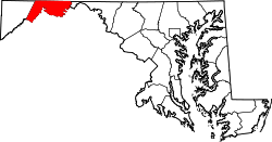
Website: gov.allconet.org Das Allegany County[1] ist ein County im Bundesstaat Maryland der Vereinigten Staaten von Amerika. Bei der Volkszählung im Jahr 2010 hatte das County 75.087 Einwohner und eine Bevölkerungsdichte von 68,1 Einwohnern pro Quadratkilometer. Der Verwaltungssitz (County Seat) ist Cumberland.
Inhaltsverzeichnis
Geografie
Das County wird im Norden durch die Mason-Dixon-Linie von Pennsylvania getrennt. Im Süden bildet der Potomac River die Grenze zu West Virginia. Das Allegany County hat eine Fläche von 1.113 Quadratkilometern; davon sind 11 Quadratkilometer (1,02 Prozent) Wasserflächen. Es grenzt an folgende Countys:
Geschichte
Das Allegany County wurde 1789 aus Teilen des Washington County gebildet. Benannt wurde es nach dem Wort oolikhanna aus der Sprache der Lenni Lenape, das Schöner Fluss bedeutet.
Demografische Daten
Historische Einwohnerzahlen Census Einwohner ± in % 1830 10.590 — 1850 22.799 — 1900 53.694 — 1910 62.411 20 % 1920 69.938 10 % 1930 79.098 10 % 1940 86.973 10 % 1950 89.556 3 % 1960 84.169 -6 % 1970 84.044 -0,1 % 1980 80.548 -4 % 1990 74.946 -7 % 2000 74.930 -0,02 % 2010 75.087 0,2 % Vor 1900[2] 1900–1990[3] 2010[4] Nach der Volkszählung im Jahr 2000 lebten im Allegany County 74.930 Menschen in 29.322 Haushalten und 18.883 Familien. Die Bevölkerungsdichte betrug 68 Personen pro Quadratkilometer. Ethnisch betrachtet setzte sich die Bevölkerung zusammen aus 93,02 Prozent Weißen, 5,35 Prozent Afroamerikanern, 0,15 Prozent amerikanischen Ureinwohnern, 0,52 Prozent Asiaten und 0,22 Prozent aus anderen ethnischen Gruppen. Unabhängig von der ethnischen Zugehörigkeit waren 0,76 Prozent der Bevölkerung spanischer oder lateinamerikanischer Abstammung. 0,75 Prozent stammten von zwei oder mehr Ethnien ab.
Von den 5.263 Haushalten hatten 26,50 Prozent Kinder unter 18 Jahren, die mit ihnen lebten. 50,60 Prozent waren verheiratete, zusammenlebende Paare, 10,30 Prozent waren allein erziehende Mütter und 35,60 Prozent waren keine Familien. 30,10 Prozent aller Haushalte waren Singlehaushalte und in 15,20 Prozent lebten Menschen im Alter von 65 Jahren oder darüber. Die durchschnittliche Haushaltsgröße lag bei 2,35 und die durchschnittliche Familiengröße bei 2,90 Personen.
20,60 Prozent der Bevölkerung war unter 18 Jahre alt, 11,20 Prozent zwischen 18 und 24, 26,80 Prozent zwischen 25 und 44, 23.50 Prozent zwischen 45 und 64 Jahre alt und 17,90 Prozent waren 65 Jahre oder älter. Das Durchschnittsalter betrug 39 Jahre. Auf 100 weibliche kamen statistisch 99,20 männliche Personen und auf 100 Frauen im Alter von 18 Jahren oder darüber kamen 96,90 Männer.
Das durchschnittliche Einkommen eines Haushaltes betrug 30.821 USD, das einer Familie 39.886 USD. Männer hatten ein durchschnittliches Einkommen von 31.316 USD, Frauen 21.334 USD. Das Pro-Kopf-Einkommen lag bei 16.780 USD. Etwa 9,70 Prozent der Familien und 14.80 Prozent der Bevölkerung lebten unterhalb der Armutsgrenze.[5]
Städte und Gemeinden
- Cumberland
- Frostburg
- Barton
- Lonaconing
- Luke
- Midland
- Westernport
Einzelnachweise
- ↑ GNIS-ID: 1713506. Abgerufen am 22. Februar 2011 (englisch).
- ↑ U.S. Census Bureau _ Census of Population and Housing Abgerufen am 18. Februar 2011
- ↑ Auszug aus Census.gov Abgerufen am 18. Februar 2011
- ↑ United States Census 2010 Abgerufen am 29. Juni 2011
- ↑ Allegany County, Maryland Datenblatt mit den Ergebnissen der Volkszählung im Jahre 2000 bei factfinder.census.gov
Weblinks
-
 Commons: Allegany County, Maryland – Sammlung von Bildern, Videos und Audiodateien
 - Offizielle Webseite
- Handelskammer des Allegany County
- Maryland State Archives - Allegany County
- www.city-data.com

Liste der Countys in Maryland
Allegany | Anne Arundel | Baltimore City | Baltimore | Calvert | Caroline | Carroll | Cecil | Charles | Dorchester | Frederick | Garrett | Harford | Howard | Kent | Montgomery | Prince George’s | Queen Anne’s | Saint Mary's | Somerset | Talbot | Washington | Wicomico | Worcester
Wikimedia Foundation.
Schlagen Sie auch in anderen Wörterbüchern nach:
Allegany County, Maryland — Infobox U.S. County county = Allegany County state = Maryland map size = 225 founded year = 1789 seat wl= Cumberland | largest city = Cumberland area total sq mi =430 area land sq mi =425 area water sq mi =4 area percentage = 1.02% census… … Wikipedia
National Register of Historic Places listings in Allegany County, Maryland — Location of Allegany County in Maryland This is a list of the National Register of Historic Places listings in Allegany County, Maryland. This is intended to be a complete list of the properties and districts on the National Register of Historic… … Wikipedia
Mexico, Allegany County, Maryland — Mexico Unincorporated community, … Wikipedia
Danville, Allegany County, Maryland — Danville Unincorporated community … Wikipedia
Bel Air, Allegany County, Maryland — Bel Air is a community located in Allegany County, Maryland, United States of America. It is an unincorporated community which, for United States Census Bureau purposes, is united with Cresaptown to form the census designated place of Cresaptown… … Wikipedia
Allegany County Transit — operates in of Allegany County, Maryland, providing the residents of Allegany County with Public Transportation. Allegany County has two types of services, a Fixed Route and a Demand Response Service. Allegany County Transit is a division of… … Wikipedia
Allegany County Public Schools — is a public school district serving Allegany County, Maryland. High Schools*Allegany High School, Cumberland, Maryland *Fort Hill High School, Cumberland, Maryland *Mountain Ridge High School, Frostburg, MarylandMiddle Schools*Braddock Middle… … Wikipedia
Allegany County — is the name of two counties in the United States of America:*Allegany County, Maryland *Allegany County, New YorkThere are three other counties spelled slightly differently but pronounced the same:*Alleghany County, North Carolina *Alleghany… … Wikipedia
Allegany County Courthouse — Infobox Historic building name = Allegany County Courthouse |thumb caption = map type = latitude = longitude = location = location town = Cumberland location country = Allegany County architect = Wright Butler client = engineer = construction… … Wikipedia
Allegany County Sheriff's Office (Maryland) — The Allegany County Sheriff s Office (ACSO) is the primary law enforcement agency for Allegany County, Maryland. The ACSO is a nationally accredited law enforcement agency servicing 430 square miles and a population of 75,300. [… … Wikipedia
Allegany County (Maryland)


18+
© Academic, 2000-2026
- Kontaktieren Sie uns: Unterstützung, Werbung
Wörterbücher Export, schritte mit PHP, Joomla, Drupal, WordPress, MODx.