- Baltimore County
-
Verwaltung US-Bundesstaat: Maryland Verwaltungssitz: Towson Adresse des
Verwaltungssitzes:Historic Courthouse
400 Washington Avenue
Towson, MD 21204Gründung: 1659 Gebildet aus: unautorisiertem Gebiet Vorwahl: 001 410 Demographie Einwohner: 805.029 (2010) Bevölkerungsdichte: 519,4 Einwohner/km² Geographie Fläche gesamt: 1.766 km² Wasserfläche: 216 km² Karte 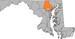
Website: www.baltimorecountymd.gov Das Baltimore County[2] ist ein County im Bundesstaat Maryland der Vereinigten Staaten von Amerika. Bei der Volkszählung im Jahr 2010 hatte das County 805.029 Einwohner und eine Bevölkerungsdichte von 519,4 Einwohnern pro Quadratkilometer. Der Verwaltungssitz (County Seat) ist Towson.
Inhaltsverzeichnis
Geografie
Das County wird im Norden durch die Mason-Dixon-Linie von Pennsylvania getrennt. Es umfasst nahezu vollständig das nicht zum County gehörende Stadtgebiet von Baltimore. Östlich davon erreicht das County die Chesapeake Bay. Das Baltimore County hat eine Fläche von 1.766 Quadratkilometern; davon sind 216 Quadratkilometer (12,23 Prozent) Wasserflächen. Es grenzt an folgende Countys:
York County
(Pennsylvania)Carroll County 
Harford County Howard County Baltimore City,
Anne Arundel CountyGeschichte
 Baron Baltimore
Das Baltimore County wurde 1659 gebildet. Benannt wurde es nach dem englischen Adligen Cecilius Calvert, 2nd Baron Baltimore (1605-1675), Lord Proprietor von Maryland.
Demografische Daten
Historische Einwohnerzahlen Census Einwohner ± in % 1900 90.755 — 1910 122.349 30 % 1920 74.817 -40 % 1930 124.565 70 % 1940 155.825 30 % 1950 270.273 70 % 1960 492.428 80 % 1970 621.077 30 % 1980 655.615 6 % 1990 692.134 6 % 2000 754.292 9 % 2010 805.029 7 % 1900–1990[3] 2000[4] 2010[5] Nach der Volkszählung im Jahr 2000 lebten im Baltimore County 754.292 Menschen in 299.877 Haushalten und 198.518 Familien. Die Bevölkerungsdichte betrug 487 Personen pro Quadratkilometer. Ethnisch betrachtet setzte sich die Bevölkerung zusammen aus 74,39 Prozent Weißen, 20.10 Prozent Afroamerikanern, 0,25 Prozent amerikanischen Ureinwohnern, 3,17 Prozent Asiaten und 0,65 Prozent aus anderen ethnischen Gruppen; 1,43 Prozent stammten von zwei oder mehr Ethnien ab. Unabhängig von der ethnischen Zugehörigkeit waren 1,83 Prozent der Bevölkerung spanischer oder lateinamerikanischer Abstammung.
Von den 299.877 Haushalten hatten 30,2 Prozent Kinder unter 18 Jahren, die mit ihnen lebten. 49,4 Prozent waren verheiratete, zusammenlebende Paare, 12,8 Prozent waren allein erziehende Mütter und 33,8 Prozent waren keine Familien. 27,3 Prozent aller Haushalte waren Singlehaushalte und in 10,1 Prozent lebten Menschen im Alter von 65 Jahren oder darüber. Die durchschnittliche Haushaltsgröße lag bei 2,46 und die durchschnittliche Familiengröße bei 3,00 Personen.
23,6 Prozent der Bevölkerung war unter 18 Jahre alt, 8,5 Prozent zwischen 18 und 24, 29,8 Prozent zwischen 25 und 44, 23,4 Prozent zwischen 45 und 64 Jahre alt und 14,6 Prozent waren 65 Jahre oder älter. Das Durchschnittsalter betrug 38 Jahre. Auf 100 weibliche kamen statistisch 90 männliche Personen und auf 100 Frauen im Alter von 18 Jahren oder darüber kamen 86 Männer.
Das durchschnittliche Einkommen eines Haushaltes betrug 50.667 USD, das einer Familie 59.998 USD. Männer hatten ein durchschnittliches Einkommen von 41.048 USD, Frauen 31.426 USD. Das Pro-Kopf-Einkommen lag bei 26.167 USD. Etwa 4,5 Prozent der Familien und 6,5 Prozent der Bevölkerung lebten unterhalb der Armutsgrenze.[6]
Städte und Gemeinden
Im Baltimore County existieren keine selbstständigen Gemeinden (incorporated communities), da es sich bei den Siedlungen praktisch nur um Vororte der Stadt Baltimore handelt. Diese sind jedoch juristisch nicht Bestandteil der Stadt. Wegen deren Größe sind vom United States Census Bureau aber eine Reihe von Census-designated places (CDP) gebildet worden:
- Edgemere
- Essex
- Garrison
- Hampton
- Kingsville
- Lansdowne-Baltimore Highlands
- Lochearn
- Lutherville-Timonium
- Mays Chapel
- Middle River
- Milford Mill
- Overlea
- Owings Mills
- Parkville
- Perry Hall
- Pikesville
- Randallstown
- Reisterstown
- Rosedale
- Rossville
- Towson
- White Marsh
- Woodlawn
Einzelnachweise
- ↑ Auszug aus dem National Register of Historic Places - Nr. 72000569 Abgerufen am 30. Juni 2011
- ↑ GNIS-ID: 1695314. Abgerufen am 22. Februar 2011 (englisch).
- ↑ Auszug aus Census.gov Abgerufen am 19. Februar 2011
- ↑ Auszug aus factfinder.census.gov Abgerufen am 18. Februar 2011
- ↑ United States Census 2010 Abgerufen am 30. Juni 2011
- ↑ Baltimore County, Maryland Datenblatt mit den Ergebnissen der Volkszählung im Jahre 2000 bei factfinder.census.gov
Weblinks
-
 Commons: Baltimore County, Maryland – Sammlung von Bildern, Videos und Audiodateien
 - Offizielle Webseite
- www.city-data.com

Liste der Countys in Maryland
Allegany | Anne Arundel | Baltimore City | Baltimore | Calvert | Caroline | Carroll | Cecil | Charles | Dorchester | Frederick | Garrett | Harford | Howard | Kent | Montgomery | Prince George’s | Queen Anne’s | Saint Mary's | Somerset | Talbot | Washington | Wicomico | Worcester
Wikimedia Foundation.
Schlagen Sie auch in anderen Wörterbüchern nach:
Baltimore County — Admin ASC 2 Code Orig. name Baltimore County Country and Admin Code US.MD.005 US … World countries Adminstrative division ASC I-II
Baltimore County Public Library — (BCPL), established in 1948, is a public library system located in central Maryland. BCPL serves Baltimore County, Maryland which surrounds but does not include the city of Baltimore, Maryland. Baltimore City is served by the Enoch Pratt Free… … Wikipedia
Baltimore County, Maryland — Infobox U.S. County county = Baltimore County state = Maryland founded year = 1659 seat wl = Towson area total sq mi =682 area land sq mi =599 area water sq mi =83 area percentage = 12.23% census estimate yr = 2005 pop = 786113 density km2 =487… … Wikipedia
Baltimore County Police Department — Infobox Law enforcement agency agencyname = Baltimore County Police Department abbreviation = BCPD patch = patchcaption = logocaption = badge = badgecaption = flagcaption = motto = mottotranslated = formed = 1874 preceding1 = employees =… … Wikipedia
Baltimore County Public Schools — is the school district in charge of all public schools in Baltimore County, Maryland, United States. The nation s 25th largest school system as of 2005,[1] it is managed by the Board of Education, headquartered in Towson. The Superintendent is Dr … Wikipedia
Baltimore County Circuit Courthouses — Infobox nrhp name = Baltimore County Courthouse nrhp type = caption = lat degrees = 39 lat minutes = 24 lat seconds = .36 lat direction = N long degrees = 76 long minutes = 36 long seconds = 21.60 long direction = W location = Towson, Maryland… … Wikipedia
Baltimore County (Maryland) — Verwaltung US Bundesstaat: Maryland Verwaltungssitz: Towson Adresse des Verwaltungssitzes: Gründung … Deutsch Wikipedia
Baltimore County State's Attorney — The current Baltimore County State s Attorney is Scott D. Shellenberger. Shellenberger took office on January 2, 2007. Shellenberger started his legal career in the Baltimore County State’s Attorney’s Office working as a law clerk while attending … Wikipedia
Baltimore County District Courthouses — The District Court of Maryland for Baltimore County District Courthouses are located in Towson, Catonsville and Essex and serve as the courts of first impression for the majority of residents in the state of Maryland. All minor traffic and most… … Wikipedia
Baltimore County Sheriff's Office — The Baltimore County Sheriff s Office (BCoSO) is the enforcement arm of the Baltimore County, Maryland court and is headquartered in the Baltimore County Courthouse, Towson, Maryland. The Baltimore County Sheriff s Office is one of the oldest in… … Wikipedia
Baltimore County


18+
© Academic, 2000-2026
- Kontaktieren Sie uns: Unterstützung, Werbung
Wörterbücher Export, schritte mit PHP, Joomla, Drupal, WordPress, MODx.