- Fermanagh (District)
-
Fermanagh District
Ceantar Fhear Manach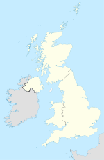

Fermanagh District 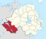
Geografie Traditionelle Grafschaft County Fermanagh
County TyroneFläche 1876 km² Verwaltungssitz Enniskillen ISO 3166-2 GB-FER Demografie Bevölkerung 62.000 (2009) Dichte 33 Ew./km² Konfessionen Protestanten 39,8 %
Katholiken 58,7 %Homepage
www.fermanagh.gov.ukFermanagh (irisch Fear Manach) ist einer der 26 nordirischen Districts. Der District wurde 1973 eingerichtet und umfasst die gesamte traditionelle Grafschaft Fermanagh sowie Teile der traditionellen Grafschaft Tyrone. Der Verwaltungssitz des flächenmäßig größten nordirischen Districts ist Enniskillen. Weitere Orte sind Lisnaskea, Irvinestown, Belleek, Belcoo, Derrylin und Rosslea. Ein Fünftel der Fläche des Districts wird von dem Gewässer Lough Erne eingenommen.
Fermanagh Council
Die Wahl zum Fermanagh Council am 11. Mai 2011 hatte folgendes Ergebnis:[1]
Partei Ergebnis 2011 Veränderung zu 2006 Sitze Stimmen Sitze Stimmen Sinn Féin 9 36,6 % 0 -0,8 % Ulster Unionist Party (UUP) 6 24,0 % 0 1,9 % Democratic Unionist Party (DUP) 4 17,3 % 0 -3,4 % Social Democratic and Labour Party (SDLP) 3 12,5 % -2 -5,4 % Traditional Unionist Voice 0 1,0 % 0 1,0 % Alliance Party 0 0,4 % 0 0,4 % Green Party 0 0,2 % 0 -0,1 % Unabhängige 1 7,3 % 1 6,9 % Sonstige 0 0,8 % 0 -0,5 % Siehe auch
Einzelnachweise
- ↑ Wahlergebnis bei BBC News (Abgerufen am 26. Juli 2011)

Antrim | Ards | Armagh | Ballymena | Ballymoney | Banbridge | Belfast | Carrickfergus | Castlereagh | Coleraine | Cookstown | Craigavon | Derry | Down | Dungannon and South Tyrone | Fermanagh | Larne | Limavady | Lisburn | Magherafelt | Moyle | Newry and Mourne | Newtownabbey | North Down | Omagh | Strabane
Wikimedia Foundation.
Schlagen Sie auch in anderen Wörterbüchern nach:
Fermanagh District — Admin ASC 2 Code Orig. name Fermanagh District Country and Admin Code GB.NIR.S2 GB … World countries Adminstrative division ASC I-II
Fermanagh District Council — NI district district name = Fermanagh District alt name = Comhairle Ceantair Fhear Manach district area rank = 1st district area = 1,876 district HQ = Enniskillen district iso = GB FER district ons = 95L protestant pc = 39.8% catholic pc = 58.7%… … Wikipedia
Fermanagh and Omagh District Council — Fermanagh and Omagh District is a proposed Northern Irish local government district. Under the latest decision by the Review of Public Administration the district would be created by merging Fermanagh District Council and Omagh District Council.… … Wikipedia
District de Fermanagh — 54° 27′ 04″ N 7° 42′ 47″ W / 54.451, 7.713 … Wikipédia en Français
Fermanagh — /feuhr man euh/, n. 1. a county in SW Northern Ireland. 50,255; 653 sq. mi. (1691 sq. km). Co. seat: Enniskillen. 2. an administrative district including this county. 50,979; 715 sq. mi. (1851 sq. km). * * * District (pop., 2001: 57,527), extreme … Universalium
District de Carrickfergus — Carrickfergus Borough Council (en) Comhairle Baile Charraig Fheargais (ga) … Wikipédia en Français
District de Cookstown — Cookstown District Council (en) Comhairle Ceantair na Coirre Críochaí (ga) Districk Cooncil o Cookestoun ( … Wikipédia en Français
Fermanagh — [fər man′ə] 1. former county of SW Northern Ireland: 724 sq mi (1,875 sq km) 2. district in SW Northern Ireland, occupying the same area: 724 sq mi (1,875 sq km); pop. 54,000 … English World dictionary
Fermanagh and South Tyrone (UK Parliament constituency) — UK constituency infobox alt Name = Fermanagh and South Tyrone Type = County Entity = Northern Ireland DivisionType = Districts Division = Fermanagh, Dungannon and South Tyrone Year = 1950 MP = Michelle Gildernew Party = Sinn Féin EP = Northern… … Wikipedia
Fermanagh — Comté de Fermanagh Comté de Fermanagh Contae An Fear Manach [[Image: |175px|Drapeau de Comté de Fermanagh]] … Wikipédia en Français
Fermanagh (District)


18+
© Academic, 2000-2026
- Kontaktieren Sie uns: Unterstützung, Werbung
Wörterbücher Export, schritte mit PHP, Joomla, Drupal, WordPress, MODx.