- Matureivavao
-
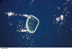
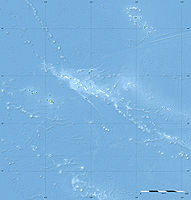
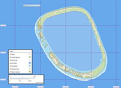
Matureivavao NASA-Bild von Matureivavao Gewässer Pazifischer Ozean Archipel Actéon-Inseln, Tuamotu-Archipel Geographische Lage 21° 29′ S, 136° 25′ W-21.483333333333-136.41666666667Koordinaten: 21° 29′ S, 136° 25′ W Anzahl der Inseln --- Landfläche 3,96 km² Lagunenfläche 18 km² Gesamtfläche 28,62 km² Einwohner (unbewohnt) Karte des Atolls Matureivavao (alter Name: Melbourne Island) ist ein Atoll des Tuamotu-Archipels in Französisch-Polynesien. Matureivavao ist das östlichste und größte Atoll der Actéon-Inseln. Matureivavao liegt 15 km westlich von Marutea Sud und 15 km südöstlich von Vahanga entfernt, die Lagune des Atolls hat keinen schiffbaren Eingang zum Meer. Administrativ gehört Matureivavao zur Gemeinde Gambier.
Die Gesamtfläche beträgt 28,62 km² (Landfläche, Riff und Lagune).[1]
Auf Matureivavao stehen einige Häuser, es ist jedoch nicht bewohnt. Bei schlechtem Wetter schwappt das Meer über das Atoll. Der Sandstrand des Atolls ist von einer üppigen Vegetation begrenzt.
Quellen
- ↑ http://www.issg.org/CII/PII/Printer%20friendly%20pages/final.restoration.vahanga.atoll_5ffinal.pdf
- Sailing Directions, Pub 126, Pacific Islands NIMA 2002; Seite 12
Weblinks
- Bild und Kurzbeschreibung (engl.)
- Vogelwelt des Atolls (engl.)
- Fauna und Flora des Atolls (PDF, engl.)
Ahe | Ahunui | Akiaki | Amanu | Anaa | Anuanuraro | Anuanurunga | Apataki | Aratika | Arutua | Faaite | Fakahina | Fakarava | Fangatau | Fangataufa | Gambier | Hao | Haraiki | Héréhérétué | Hikueru | Hiti | Katiu | Kauehi | Kaukura | Makatea | Makemo | Mangareva | Manihi | Manuhangi | Maria Est | Marokau | Marutea Nord | Marutea Sud | Mataiva | Matureivavao | Morane | Motutunga | Mururoa | Napuka | Nengonengo | Niau | Nihiru | Nukutavake | Nukutepipi | Paraoa | Pinaki | Puka-Puka | Puka Rua | Rangiroa | Raraka | Raroia | Ravahere | Reao | Reitoru | Rekareka | Taenga | Tahanea | Taiaro | Takapoto | Takaroa | Takume | Tatakoto | Tauere | Tekokota | Tematangi | Temoe | Tenararo | Tenarunga | Tepoto Nord | Tepoto Sud | Tikehau | Tikei | Toau | Tuanake | Tureia | Vahanga | Vahitahi | Vairaatea | Vanavana
Wikimedia Foundation.


