- Calumet County
-
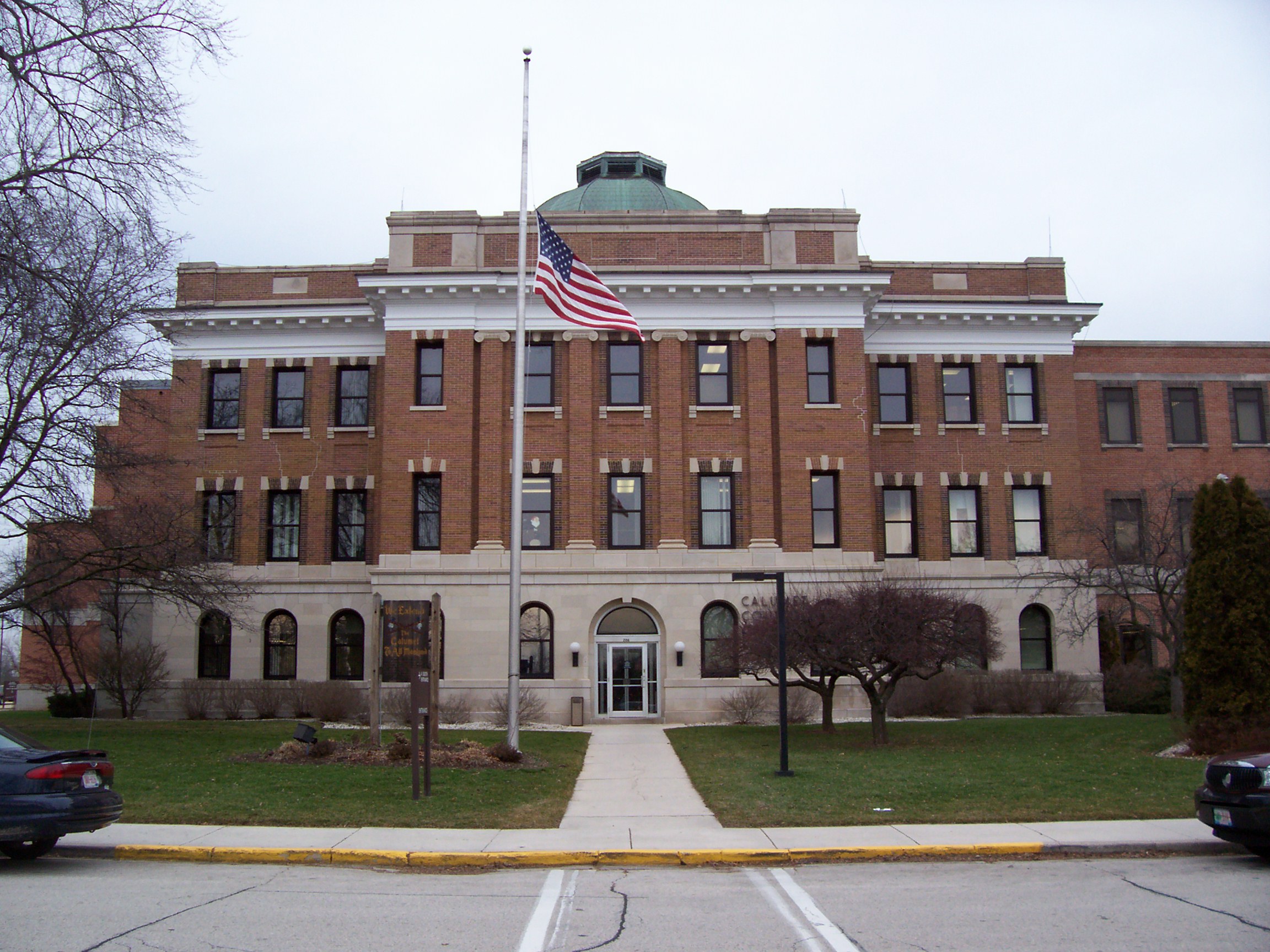
Verwaltung US-Bundesstaat: Wisconsin Verwaltungssitz: Chilton Adresse des
Verwaltungssitzes:County Courthouse
206 Court Street
Chilton, WI 53014-0000Gründung: 1836 Gebildet aus: Wisconsin-Territorium Vorwahl: 001 920 Demographie Einwohner: 48.971 (2010) Bevölkerungsdichte: 59,1 Einwohner/km² Geographie Fläche gesamt: 1.028 km² Wasserfläche: 200 km² Karte 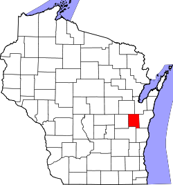
Website: www.co.calumet.wi.us Calumet County[2] ist ein County im Bundesstaat Wisconsin der Vereinigten Staaten von Amerika. Bei der Volkszählung im Jahr 2010 hatte das County 48.971 Einwohner und eine Bevölkerungsdichte von 59,1 Einwohnern pro Quadratkilometer. Der Verwaltungssitz (County Seat) ist Chilton.
Inhaltsverzeichnis
Geografie
Das County liegt im Osten von Wisconsin, ist etwa 40 km vom Michigansee entfernt und hat eine Fläche von 1028 Quadratkilometern, wovon 200 Quadratkilometer Wasserfläche sind. Es grenzt an folgende Countys:
Outagamie County Brown County Winnebago County 
Manitowoc County Fond du Lac County Sheboygan County Geschichte
Calumet County wurde 1836 aus Teilen des Wisconsin-Territoriums gebildet. Benannt wurde es nach dem französischen Wort für die indianische Friedenspfeife. Native Americans aus New York State wurden in den südwestlichen Teil ab 1830 umgesiedelt. Viele der frühen Bewohner der Holyland Region im südlichen Teil waren Auswanderer aus Schleswig-Holstein in den 1840er Jahren.
Demografische Daten
Historische Einwohnerzahlen Census Einwohner ± in % 1900 17.078 — 1910 16.701 -2 % 1920 17.228 3 % 1930 16.848 -2 % 1940 17.618 5 % 1950 18.840 7 % 1960 22.268 20 % 1970 27.604 20 % 1980 30.867 10 % 1990 34.291 10 % 2000 40.631 20 % 2010 48.971 20 % 1900–1990[3] 2010[4]  Bevölkerungspyramide (2000) des Calumet County
Nach der Volkszählung im Jahr 2000 lebten im Calumet County 40.631 Menschen in 14.910 Haushalten. 11.167 Familien lebten im County. Die Bevölkerungsdichte betrug 49 Personen pro Quadratkilometer. Ethnisch betrachtet setzte sich die Bevölkerung zusammen aus 96,68 Prozent Weißen, 0,31 Prozent Afroamerikanern, 0,34 Prozent Indianern, 1,55 Prozent Asiatischen Amerikanern, 0,01 Prozent Pazifischen Insulanern und 0,38 Prozent aus anderen ethnischen Gruppen; 0,74 Prozent stammten von zwei oder mehr Ethnien ab. 1,07 Prozent der Bevölkerung waren Hispanics oder Latinos, die verschiedenen der genannten Gruppen angehörten.
Von den 14.910 Haushalten hatten 38,5 Prozent Kinder unter 18 Jahren, die mit ihnen zusammen lebten. 65,0 Prozent davon waren verheiratete, zusammenlebende Paare, 6,5 Prozent waren allein erziehende Mütter. 25,1 Prozent waren keine Familien. 20,4 Prozent waren Singlehaushalte und in 7,5 Prozent lebten Menschen mit 65 Jahren oder älter. Die durchschnittliche Haushaltsgröße betrug 2,70 und die durchschnittliche Familiengröße lag 3,15 Personen.
28,6 Prozent der Bevölkerung waren unter 18 Jahre alt, 7,2 Prozent zwischen 18 und 24, 32,0 Prozent zwischen 25 und 44, 21,4 Prozent zwischen 45 und 64, und 10,8 Prozent waren 65 Jahre oder älter. Das Durchschnittsalter betrug 35 Jahre. Auf 100 weibliche kamen statistisch 100,0 männliche Personen. [5]
Städte und Gemeinden
- Kiel2
- Menasha3
- New Holstein
1 - teilweise im Outgamie und im Winnebago County
2 - teilweise im Manitowoc County
3 - teilweise im Winnebago CountyEinzelnachweise
- ↑ Auszug aus dem National Register of Historic Places - Nr. 82000640 Abgerufen am 16. März 2011
- ↑ Calumet County im Geographic Names Information System des United States Geological Survey. Abgerufen am 22. Februar 2011
- ↑ Auszug aus Census.gov Abgerufen am 28. Februar 2011
- ↑ United States Census 2010 Abgerufen am 16. März 2011
- ↑ Calumet County, Wisconsin, Datenblatt mit den Ergebnissen der Volkszählung im Jahre 2000 bei factfinder.census.gov.
Weblinks
-
 Commons: Calumet County, Wisconsin – Sammlung von Bildern, Videos und Audiodateien
 - Offizielle Webseite
- Travel Calumet
- www.city-data.com

Liste der Countys in Wisconsin
Adams | Ashland | Barron | Bayfield | Brown | Buffalo | Burnett | Calumet | Chippewa | Clark | Columbia | Crawford | Dane | Dodge | Door | Douglas | Dunn | Eau Claire | Florence | Fond du Lac | Forest | Grant | Green | Green Lake | Iowa | Iron | Jackson | Jefferson | Juneau | Kenosha | Kewaunee | La Crosse | Lafayette | Langlade | Lincoln | Manitowoc | Marathon | Marinette | Marquette | Menominee | Milwaukee | Monroe | Oconto | Oneida | Outagamie | Ozaukee | Pepin | Pierce | Polk | Portage | Price | Racine | Richland | Rock | Rusk | Sauk | Sawyer | Shawano | Sheboygan | St. Croix | Taylor | Trempealeau | Vernon | Vilas | Walworth | Washburn | Washington | Waukesha | Waupaca | Waushara | Winnebago | Wood
Wikimedia Foundation.
Schlagen Sie auch in anderen Wörterbüchern nach:
Calumet County — Admin ASC 2 Code Orig. name Calumet County Country and Admin Code US.WI.015 US … World countries Adminstrative division ASC I-II
Calumet County Parks — Calumet County, Wisconsin maintains three county parks and two harbors. Ledge View Nature Center Ledge View Nature Center is located two miles south of Chilton, Wisconsin. The nature center was built in 1981.Visitors can walk or ski trails, or… … Wikipedia
Calumet County, Wisconsin — Infobox U.S. County county = Calumet County state = Wisconsin map size = 200 founded = 1836 seat = Chilton largest city = Chilton area total sq mi = 397 area total km2 = 1028 area land sq mi = 320 area land km2 = 828 area water sq mi = 77 area… … Wikipedia
Calumet County Park Group — Infobox nrhp | name =Calumet County Park Group nrhp type = caption = nearest city= Stockbridge, Wisconsin locmapin = Wisconsin area = architect= architecture= No Style Listed added = December 29, 1997cite… … Wikipedia
National Register of Historic Places listings in Calumet County, Wisconsin — Buildings, sites, districts, and objects in Calumet County listed on the National Register of Historic Places See also: National Register of Historic Places listings in Wisconsin This National Park Service list is complete through NPS recent… … Wikipedia
Woodville, Calumet County, Wisconsin — There is also the Village of Woodville in St. Croix County. Infobox Settlement official name = Woodville, Wisconsin settlement type = Town nickname = motto = imagesize = image caption = image mapsize = 250px map caption = Location of Woodville,… … Wikipedia
Harrison, Calumet County, Wisconsin — Infobox Settlement official name = Harrison, Wisconsin settlement type = Town nickname = motto = imagesize = image caption = image mapsize = 250px map caption = Location of Harrison, Wisconsin mapsize1 = map caption1 = subdivision type = Country… … Wikipedia
Calumet — ist der Name mehrerer Orte in den Vereinigten Staaten: Calumet (Alabama) Calumet (Arizona) Calumet (Arkansas) Calumet (Iowa) Calumet (Louisiana) Calumet (Michigan) Calumet (Minnesota) Calumet (Missouri) Calumet (Nevada) Calumet (Oklahoma) Calumet … Deutsch Wikipedia
Calumet — A Calumet is a Native American smoking pipe carved out of pipestone, sometimes called a peace pipe .Calumet is also the name (or part of the name) of a number of places in North America:;In the United States *Calumet, Colorado *Calumet, Iowa… … Wikipedia
Calumet, Wisconsin — There is also a county in Wisconsin called Calumet County, Wisconsin which is adjacent to the township. Infobox Settlement official name = Calumet, Wisconsin settlement type = Town nickname = motto = imagesize = image caption = image mapsize =… … Wikipedia
Calumet County


18+
© Academic, 2000-2026
- Kontaktieren Sie uns: Unterstützung, Werbung
Wörterbücher Export, schritte mit PHP, Joomla, Drupal, WordPress, MODx.