- Kenosha County
-
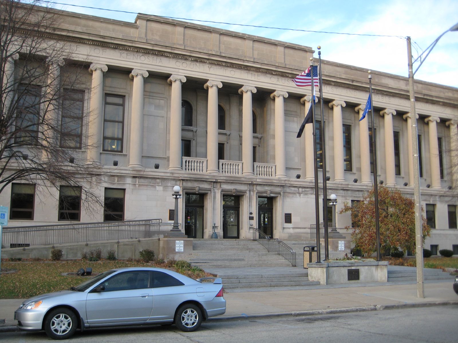
Verwaltung US-Bundesstaat: Wisconsin Verwaltungssitz: Kenosha Adresse des
Verwaltungssitzes:County Administration Building
1010, 56th St.
Kenosha, WI 53140-3738Gründung: 1850 Gebildet aus: Racine County Vorwahl: 001 262 Demographie Einwohner: 166.426 (2010) Bevölkerungsdichte: 235,4 Einwohner/km² Geographie Fläche gesamt: 1.954 km² Wasserfläche: 1.247 km² Karte 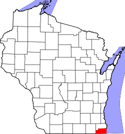
Website: www.co.kenosha.wi.us Kenosha County[2] ist ein County im Bundesstaat Wisconsin der Vereinigten Staaten von Amerika. Bei der Volkszählung im Jahr 2010 hatte das County 166.426 Einwohner und eine Bevölkerungsdichte von 235,4 Einwohnern pro Quadratkilometer. Der Verwaltungssitz (County Seat) ist Kenosha.
Das Kenosha County ist Bestandteil der Metropolregion Chicago.
Inhaltsverzeichnis
Geografie
Das County liegt im äußersten Südosten von Wisconsin, grenzt im Osten an den Michigansee, im Süden an Illinois und hat eine Fläche von 1954 Quadratkilometern, wovon 1247 Quadratkilometer Wasserfläche sind. Es grenzt an folgende Countys:
Racine County Walworth County 
Mc Henry County
(Illinois)Lake County
(Illinois)Geschichte
Das Kenosha County wurde 1850 aus Teilen des Racine County gebildet. Benannt wurde es, ebenso wie die Bezirkshauptstadt, nach einem indianischen Ausdruck.
Demografische Daten
Historische Einwohnerzahlen Census Einwohner ± in % 1850 10.734 — 1860 13.900 30 % 1870 13.147 -5 % 1880 13.550 3 % 1890 15.581 10 % 1900 21.707 40 % 1910 32.929 50 % 1920 51.284 60 % 1930 63.277 20 % 1940 63.505 0,4 % 1950 75.238 20 % 1960 100.615 30 % 1970 117.917 20 % 1980 123.137 4 % 1990 128.181 4 % 2000 149.577 20 % 2010 166.426 10 % Vor 1900[3]  Alterspyramide (2000) des Kenosha County
Nach der Volkszählung im Jahr 2000 lebten im Kenosha County 149.577 Menschen in 56.057 Haushalten. 38.455 Familien lebten im County. Die Bevölkerungsdichte betrug 212 Personen pro Quadratkilometer. Ethnisch betrachtet setzte sich die Bevölkerung zusammen aus 88,38 Prozent Weißen, 5,08 Prozent Afroamerikanern, 0,38 Prozent amerikanischen Ureinwohnern, 0,92 Prozent Asiaten, 0,04 Prozent Bewohnern aus dem pazifischen Inselraum und 3,29 Prozent aus anderen ethnischen Gruppen; 1,91 Prozent stammten von zwei oder mehr Ethnien ab. 7,19 Prozent der Bevölkerung waren spanischer oder lateinamerikanischer Abstammung, die verschiedenen der genannten Gruppen angehörten.
Von den 56.057 Haushalten hatten 34,8 Prozent Kinder unter 18 Jahren, die mit ihnen zusammen lebten. 52,7 Prozent davon waren verheiratete, zusammenlebende Paare, 11,5 Prozent waren allein erziehende Mütter. 31,4 Prozent waren keine Familien. 25,5 Prozent waren Singlehaushalte und in 9,1 Prozent lebten Menschen mit 65 Jahren oder älter. Die durchschnittliche Haushaltsgröße lag bei 2,60 und die durchschnittliche Familiengröße betrug 3,13 Personen.
27,1 Prozent der Bevölkerung waren unter 18 Jahre alt, 9,4 Prozent zwischen 18 und 24, 31,3 Prozent zwischen 25 und 44, 20,7 Prozent zwischen 45 und 64, und 11,5 Prozent waren 65 Jahre oder älter. Das Durchschnittsalter betrug 35 Jahre. Auf 100 weibliche kamen statistisch 98,3 männliche Personen.[6]
Städte und Gemeinden
- Bristol
- Genoa City1
- Kenosha
- Paddock Lake
- Pleasant Prairie
- Silver Lake
- Twin Lakes
1 - teilweise im Walworth County
Einzelnachweise
- ↑ Auszug aus dem National Register of Historic Places - Nr. 82000677 Abgerufen am 8. April 2011
- ↑ Kenosha County im Geographic Names Information System des United States Geological Survey Abgerufen am 22. Februar 2011
- ↑ U.S. Census Bureau _ Census of Population and Housing Abgerufen am 28. Februar 2011
- ↑ Auszug aus Census.gov. Abgerufen am 28. Februar 2011
- ↑ United States Census 2010 Abgerufen am 8. April 2011
- ↑ Kenosha County, Wisconsin, Datenblatt mit den Ergebnissen der Volkszählung im Jahre 2000 bei factfinder.census.gov
Weblinks
-
 Commons: Kenosha County, Wisconsin – Sammlung von Bildern, Videos und Audiodateien
 - Offizielle Webseite
- Kenosha Area Convention & Visitors Bureau
- www.city-data.com

Liste der Countys in Wisconsin
Adams | Ashland | Barron | Bayfield | Brown | Buffalo | Burnett | Calumet | Chippewa | Clark | Columbia | Crawford | Dane | Dodge | Door | Douglas | Dunn | Eau Claire | Florence | Fond du Lac | Forest | Grant | Green | Green Lake | Iowa | Iron | Jackson | Jefferson | Juneau | Kenosha | Kewaunee | La Crosse | Lafayette | Langlade | Lincoln | Manitowoc | Marathon | Marinette | Marquette | Menominee | Milwaukee | Monroe | Oconto | Oneida | Outagamie | Ozaukee | Pepin | Pierce | Polk | Portage | Price | Racine | Richland | Rock | Rusk | Sauk | Sawyer | Shawano | Sheboygan | St. Croix | Taylor | Trempealeau | Vernon | Vilas | Walworth | Washburn | Washington | Waukesha | Waupaca | Waushara | Winnebago | Wood
Wikimedia Foundation.
Schlagen Sie auch in anderen Wörterbüchern nach:
Kenosha County — Admin ASC 2 Code Orig. name Kenosha County Country and Admin Code US.WI.059 US … World countries Adminstrative division ASC I-II
Kenosha County, Wisconsin — Infobox U.S. County county = Kenosha County state = Wisconsin map size = 225 founded = 1850 seat = Kenosha | area total sq mi =754 area land sq mi =273 area water sq mi =481 area percentage = 63.83% census yr = 2006 pop = 162001 density km2 =212… … Wikipedia
National Register of Historic Places listings in Kenosha County, Wisconsin — Buildings, sites, structures, districts, and objects in Kenosha County listed on the National Register of Historic Places See also: National Register of Historic Places listings in Wisconsin This National Park Service list is complete through NPS … Wikipedia
Wheatland, Kenosha County, Wisconsin — Infobox Settlement official name = Wheatland, Wisconsin settlement type = Town nickname = motto = imagesize = image caption = image mapsize = 250px map caption = Location of Wheatland, Wisconsin mapsize1 = map caption1 = subdivision type =… … Wikipedia
Montgomery Lake (Kenosha County, Wisconsin) — Montgomery Lake Location Kenosha County, Wisconsin Coordinates 42°33′09″N 088°05′13″W … Wikipedia
Bristol, Kenosha County, Wisconsin — Infobox Settlement official name = Bristol, Wisconsin settlement type = Town nickname = motto = imagesize = image caption = image mapsize = 250px map caption = Location of Bristol, Wisconsin mapsize1 = map caption1 = subdivision type = Country… … Wikipedia
Aurora, Kenosha County, Wisconsin — Aurora is now part of the city of Kenosha, Wisconsin, in Kenosha County, Wisconsin, but was the site of one of the area s earliest post offices, opened in the early 1830s at the Willis Tavern, the Aurora community center on the west side of the… … Wikipedia
Brighton, Kenosha County, Wisconsin — Infobox Settlement official name = Brighton, Wisconsin settlement type = Town nickname = motto = imagesize = image caption = image mapsize = 250px map caption = Location of Brighton, Wisconsin mapsize1 = map caption1 = subdivision type = Country… … Wikipedia
Paris, Kenosha County, Wisconsin — Infobox Settlement official name = Paris, Wisconsin settlement type = Town nickname = motto = imagesize = image caption = image mapsize = 250px map caption = Location of Paris, Wisconsin mapsize1 = map caption1 = subdivision type = Country… … Wikipedia
Salem, Kenosha County, Wisconsin — Infobox Settlement official name = Salem, Wisconsin settlement type = Town nickname = motto = imagesize = image caption = image mapsize = 250px map caption = Location of Salem, Wisconsin mapsize1 = map caption1 = subdivision type = Country… … Wikipedia
Kenosha County


18+
© Academic, 2000-2026
- Kontaktieren Sie uns: Unterstützung, Werbung
Wörterbücher Export, schritte mit PHP, Joomla, Drupal, WordPress, MODx.