- Iowa County (Wisconsin)
-
Verwaltung US-Bundesstaat: Wisconsin Verwaltungssitz: Dodgeville Adresse des
Verwaltungssitzes:County Courthouse
222 North Iowa Street
Dodgeville, WI 53533-1557Gründung: 9. Oktober 1829 Gebildet aus: Crawford County Vorwahl: 001 608 Demographie Einwohner: 23.687 (2010) Bevölkerungsdichte: 12 Einwohner/km² Geographie Fläche gesamt: 1.989 km² Wasserfläche: 14 km² Karte 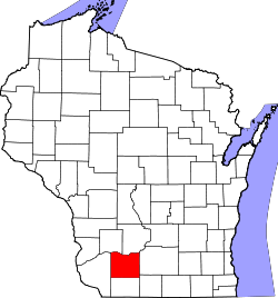
Website: www.iowacounty.org Iowa County[1] ist ein County im Bundesstaat Wisconsin der Vereinigten Staaten von Amerika. Bei der Volkszählung im Jahr 2010 hatte das County 23.687 Einwohner und eine Bevölkerungsdichte von 12 Einwohnern pro Quadratkilometer. Der Verwaltungssitz (County Seat) ist Dodgeville, das nach Henry Dodge, einem General und frühen Gouverneur des Wisconsin-Territoriums benannt wurde.
Das Iowa County ist das Zentrum der Metropolregion Madison.
Inhaltsverzeichnis
Geografie
Das County liegt im Südwesten von Wisconsin, ist im Süden etwa 50 km von Illinois, im Westen etwa 70 km von Iowa entfernt und hat eine Fläche von 1989 Quadratkilometern, wovon 14 Quadratkilometer Wasserfläche sind. Es grenzt an folgende Countys:
Richland County Sauk County Grant County 
Dane County Lafayette County Green County Geschichte
Iowa County wurde am 9. Oktober 1829 aus Teilen des Crawford County gebildet. Benannt wurde es nach dem indigenen Volk der Iowa.
Demografische Daten
Historische Einwohnerzahlen Census Einwohner ± in % 1900 23.114 — 1910 22.497 -3 % 1920 21.504 -4 % 1930 20.039 -7 % 1940 20.595 3 % 1950 19.610 -5 % 1960 19.631 0,1 % 1970 19.306 -2 % 1980 19.802 3 % 1990 20.150 2 % 2000 22.780 10 % 2010 23.687 4 % 1900–1990[2] 2010[3]  Alterspyramide (2000) des Iowa County
Nach der Volkszählung im Jahr 2000 lebten im Iowa County 22.780 Menschen in 8.764 Haushalten. 6.213 Familien lebten im County. Die Bevölkerungsdichte betrug 12 Personen pro Quadratkilometer. Ethnisch betrachtet setzte sich die Bevölkerung zusammen aus 98,70 Prozent Weißen, 0,17 Prozent Afroamerikanern, 0,11 Prozent amerikanischen Ureinwohnern, 0,34 Prozent Asiaten, 0,01 Prozent Bewohnern aus dem pazifischen Inselraum und 0,11 Prozent aus anderen ethnischen Gruppen; 0,55 Prozent stammten von zwei oder mehr Ethnien ab. 0,33 Prozent der Bevölkerung waren spanischer oder lateinamerikanischer Abstammung, die verschiedenen der genannten Gruppen angehörten.
Von den 8.764 Haushalten hatten 34,6 Prozent Kinder unter 18 Jahren, die mit ihnen zusammen lebten. 59,5 Prozent davon waren verheiratete, zusammenlebende Paare, 7,6 Prozent waren allein erziehende Mütter. 29,1 Prozent waren keine Familien. 24,3 Prozent waren Singlehaushalte und in 10,1 Prozent lebten Menschen mit 65 Jahren oder älter. Die durchschnittliche Haushaltsgröße lag bei 2,56 und die durchschnittliche Familiengröße bei 3,06 Personen.
27,1 Prozent der Bevölkerung waren unter 18 Jahre alt, 6,6 Prozent zwischen 18 und 24, 30,4 Prozent zwischen 25 und 44, 22,5 Prozent zwischen 45 und 64, und 13,3 Prozent waren 65 Jahre oder älter. Das Durchschnittsalter betrug 37 Jahre. Auf 100 weibliche kamen statistisch 99,3 männliche Personen.[4]
Städte und Gemeinden
- Arena
- Avoca
- Barneveld
- Blanchardville
- Cobb
- Dodgeville
- Highland
- Hollandale
- Linden
- Livingston
- Mineral Point
- Montfort1
- Muscoda1
- Rewey
- Ridgeway
1 - teilweise im Grant County
Einzelnachweise
- ↑ Iowa County im Geographic Names Information System des United States Geological Survey Abgerufen am 22. Februar 2011
- ↑ Auszug aus Census.gov Abgerufen am 28. Februar 2011
- ↑ United States Census 2010 Abgerufen am 4. April 2011
- ↑ Iowa County, Wisconsin Datenblatt mit den Ergebnissen der Volkszählung im Jahre 2000 bei factfinder.census.gov
Weblinks
-
 Commons: Iowa County, Wisconsin – Sammlung von Bildern, Videos und Audiodateien
 - Offizielle Webseite
- Iowa County Area Economic Development Corporation
- www.city-data.com

Liste der Countys in Wisconsin
Adams | Ashland | Barron | Bayfield | Brown | Buffalo | Burnett | Calumet | Chippewa | Clark | Columbia | Crawford | Dane | Dodge | Door | Douglas | Dunn | Eau Claire | Florence | Fond du Lac | Forest | Grant | Green | Green Lake | Iowa | Iron | Jackson | Jefferson | Juneau | Kenosha | Kewaunee | La Crosse | Lafayette | Langlade | Lincoln | Manitowoc | Marathon | Marinette | Marquette | Menominee | Milwaukee | Monroe | Oconto | Oneida | Outagamie | Ozaukee | Pepin | Pierce | Polk | Portage | Price | Racine | Richland | Rock | Rusk | Sauk | Sawyer | Shawano | Sheboygan | St. Croix | Taylor | Trempealeau | Vernon | Vilas | Walworth | Washburn | Washington | Waukesha | Waupaca | Waushara | Winnebago | Wood
Wikimedia Foundation.
Schlagen Sie auch in anderen Wörterbüchern nach:
Iowa County, Wisconsin — Infobox U.S. County county = Iowa County state = Wisconsin founded year = 1829 founded date = October 9 seat wl = Dodgeville largest city wl = Dodgeville area total sq mi = 768 area total km2 = 1989 area land sq mi = 763 area land km2 = 1975 area … Wikipedia
National Register of Historic Places listings in Iowa County, Wisconsin — Map of all coordinates from Google Map of all coordinates from Bing … Wikipedia
Highland, Iowa County, Wisconsin — Infobox Settlement official name = Highland, Wisconsin settlement type = Town nickname = motto = imagesize = image caption = image mapsize = map caption = mapsize1 = map caption1 = subdivision type = Country subdivision name = United States… … Wikipedia
Eden, Iowa County, Wisconsin — Infobox Settlement official name = Eden, Wisconsin settlement type = Town nickname = motto = imagesize = image caption = image mapsize = 250px map caption = Location of Eden, Wisconsin mapsize1 = map caption1 = subdivision type = Country… … Wikipedia
Wyoming, Iowa County, Wisconsin — Infobox Settlement official name = Wyoming, Wisconsin settlement type = Town nickname = motto = imagesize = image caption = image mapsize = 250px map caption = Location of Wyoming, Wisconsin mapsize1 = map caption1 = subdivision type = Country… … Wikipedia
Iowa County — is the name of two counties in the United States:* Iowa County, Iowa * Iowa County, Wisconsin … Wikipedia
Iowa County — Es gibt in den Vereinigten Staaten zwei Countys mit dem Namen Iowa County: Iowa County (Iowa) Iowa County (Wisconsin) Diese Seite ist eine Begriffsklärung zur Unterscheidung mehrerer mit demselben Wort bezeichne … Deutsch Wikipedia
Iowa County Courthouse — bezeichnet mehrere gleichnamige, im NRHP gelistete, Objekte: Iowa County Courthouse (Iowa), ID Nr. 81000247 Iowa County Courthouse (Wisconsin), ID Nr. 72000053 Diese Seite ist eine Begriffsklärung zur Unterscheidung mehrerer mit … Deutsch Wikipedia
Grant County, Wisconsin — Location in the state of Wisconsin … Wikipedia
Green County, Wisconsin — Location in the state of Wisconsin … Wikipedia
Iowa County (Wisconsin)


18+
© Academic, 2000-2025
- Kontaktieren Sie uns: Unterstützung, Werbung
Wörterbücher Export, schritte mit PHP, Joomla, Drupal, WordPress, MODx.