- Walworth County (Wisconsin)
-
Verwaltung US-Bundesstaat: Wisconsin Verwaltungssitz: Elkhorn Adresse des
Verwaltungssitzes:County Courthouse
100 W Walworth
Elkhorn, WI 53121-1769Gründung: 1836 Gebildet aus: Original-County Vorwahl: 001 262 Demographie Einwohner: 102.228 (2010) Bevölkerungsdichte: 71,1 Einwohner/km² Geographie Fläche gesamt: 1.493 km² Wasserfläche: 55 km² Karte 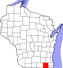
Website: www.co.walworth.wi.us Walworth County[1] ist ein County im Bundesstaat Wisconsin der Vereinigten Staaten von Amerika. Bei der Volkszählung im Jahr 2010 hatte das County 102.228 Einwohner und eine Bevölkerungsdichte von 71,1 Einwohnern pro Quadratkilometer. Der Verwaltungssitz (County Seat) ist Elkhorn.
Inhaltsverzeichnis
Geografie
Das County liegt im Südosten von Wisconsin, grenzt im Süden an Illinois, ist im Osten etwa 60 km vom Michigansee entfernt und hat eine Fläche von 1493 Quadratkilometern, wovon 55 Quadratkilometer Wasserfläche sind. Es grenzt an folgende Countys:
Jefferson County Waukesha County Rock County 
Racine County,
Kenosha CountyBoone County
(Illinois)McHenry County
(Illinois)Geschichte
Walworth County wurde 1836 als Original-County aus Teilen des Wisconsin-Territoriums gebildet. Benannt wurde es nach Reuben Hyde Walworth, einem New Yorker Juristen und Staatsmann.
Demografische Daten
Historische Einwohnerzahlen Census Einwohner ± in % 1850 17.862 — 1860 26.496 50 % 1870 25.972 -2 % 1880 26.249 1 % 1890 27.860 6 % 1900 29.259 5 % 1910 29.614 1 % 1920 29.327 -1 % 1930 31.058 6 % 1940 33.103 7 % 1950 41.584 30 % 1960 52.368 30 % 1970 63.444 20 % 1980 71.507 10 % 1990 75.000 5 % 2000 93.759 30 % 2010 102.228 9 % Vor 1900[2]  Alterspyramide (2000) des Walworth County
Nach der Volkszählung im Jahr 2000 lebten im Walworth County 93.759 Menschen in 34.522 Haushalten. 23.267 Familien lebten im County. Die Bevölkerungsdichte betrug 65 Personen pro Quadratkilometer. Ethnisch betrachtet setzte sich die Bevölkerung zusammen aus 94,49 Prozent Weißen, 0,84 Prozent Afroamerikanern, 0,23 Prozent amerikanischen Ureinwohnern, 0,65 Prozent Asiaten, 0,03 Prozent Bewohnern aus dem pazifischen Inselraum und 2,62 Prozent aus anderen ethnischen Gruppen; 1,14 Prozent stammten von zwei oder mehr Ethnien ab. 6,54 Prozent der Bevölkerung waren spanischer oder lateinamerikanischer Abstammung, die verschiedenen der genannten Gruppen angehörten.
Von den 34.522 Haushalten hatten 31,8 Prozent Kinder unter 18 Jahren, die mit ihnen zusammen lebten. 55,4 Prozent davon waren verheiratete, zusammenlebende Paare, 8,2 Prozent waren allein erziehende Mütter. 32,6 Prozent waren keine Familien. 24,7 Prozent waren Singlehaushalte und in 9,2 Prozent lebten Menschen mit 65 Jahren oder älter. Die durchschnittliche Haushaltsgröße lag bei 2,57 und die durchschnittliche Familiengröße bei 3,07 Personen.
24,2 Prozent der Bevölkerung waren unter 18 Jahre alt, 13,8 Prozent zwischen 18 und 24, 27,6 Prozent zwischen 25 und 44, 21,8 Prozent zwischen 45 und 64, und 12,7 Prozent waren 65 Jahre oder älter. Das Durchschnittsalter betrug 35 Jahre. Auf 100 weibliche kamen statistisch 98,9 männliche Personen.[5]
Städte und Gemeinden
- Burlington1
- Delavan
- Elkhorn
- Lake Geneva
- Whitewater4
- Darien
- East Troy
- Fontana-on-Geneva Lake
- Genoa City2
- Mukwonago3
- Sharon
- Walworth
- Williams Bay
- Como
- Delavan Lake
- Pell Lake
- Potter Lake
- Powers Lake2
1 - teilweise im Racine County
2 - teilweise im Kenosha County
3 - teilweise im Waukesha County
4 - teilweise im Jefferson CountyEinzelnachweise
- ↑ Walworth County im Geographic Names Information System des United States Geological Survey Abgerufen am 22. Februar 2011
- ↑ U.S. Census Bureau _ Census of Population and Housing. Abgerufen am 28. Februar 2011
- ↑ Auszug aus Census.gov Abgerufen am 28. Februar 2011
- ↑ United States Census 2010 Abgerufen am 13. April 2011
- ↑ Walworth County, Wisconsin Datenblatt mit den Ergebnissen der Volkszählung im Jahre 2000 bei factfinder.census.gov
Weblinks

Liste der Countys in Wisconsin
Adams | Ashland | Barron | Bayfield | Brown | Buffalo | Burnett | Calumet | Chippewa | Clark | Columbia | Crawford | Dane | Dodge | Door | Douglas | Dunn | Eau Claire | Florence | Fond du Lac | Forest | Grant | Green | Green Lake | Iowa | Iron | Jackson | Jefferson | Juneau | Kenosha | Kewaunee | La Crosse | Lafayette | Langlade | Lincoln | Manitowoc | Marathon | Marinette | Marquette | Menominee | Milwaukee | Monroe | Oconto | Oneida | Outagamie | Ozaukee | Pepin | Pierce | Polk | Portage | Price | Racine | Richland | Rock | Rusk | Sauk | Sawyer | Shawano | Sheboygan | St. Croix | Taylor | Trempealeau | Vernon | Vilas | Walworth | Washburn | Washington | Waukesha | Waupaca | Waushara | Winnebago | Wood


Wikimedia Foundation.