- Crawford County (Wisconsin)
-
Verwaltung US-Bundesstaat: Wisconsin Verwaltungssitz: Prairie du Chien Adresse des
Verwaltungssitzes:County Courthouse
220 North Beaumont Road
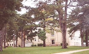
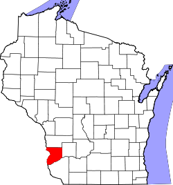
Prairie Du Chien, WI 53821-1405Gründung: 1818 Gebildet aus: Wisconsin-Territorium Vorwahl: 001 608 Demographie Einwohner: 16.644 (2010) Bevölkerungsdichte: 11,2 Einwohner/km² Geographie Fläche gesamt: 1.552 km² Wasserfläche: 69 km² Karte Website: crawfordcountywi.org Crawford County[2] ist ein County im Bundesstaat Wisconsin der Vereinigten Staaten von Amerika. Bei der Volkszählung im Jahr 2010 hatte das County 16.644 Einwohner und eine Bevölkerungsdichte von 11,2 Einwohnern pro Quadratkilometer. Der Verwaltungssitz (County Seat) ist Prairie du Chien, das nach dem französischen Namen von Prairie of the Dog benannt wurde, einem indianischen Häuptling.
Inhaltsverzeichnis
Geografie
Das County liegt im Südwesten von Wisconsin, grenzt an Iowa, getrennt durch den Mississippi River, der die natürliche Grenze darstellt. Das Crawford County erstreckt sich über eine Fläche von 1552 Quadratkilometern, wovon 69 Quadratkilometer Wasserfläche sind. Es grenzt an folgende Countys:
Vernon County Allamakee County (Iowa) 
Richland County Clayton County (Iowa) Grant County Geschichte
Das Crawford County wurde 1818 als Original-County aus Teilen des Wisconsin-Territoriums gebildet. Benannt wurde es nach William H. Crawford, dem Finanzminister unter James Monroe in dieser Zeit. Der erste Handelsposten hier wurde 1685 eingerichtet.
Demografische Daten
Historische Einwohnerzahlen Census Einwohner ± in % 1900 17.286 — 1910 16.288 -6 % 1920 16.772 3 % 1930 16.781 0,05 % 1940 18.328 9 % 1950 17.652 -4 % 1960 16.351 -7 % 1970 15.252 -7 % 1980 16.556 9 % 1990 15.940 -4 % 2000 17.243 8 % 2010 16.644 -3 % 1900-1990[3] 2010[4] Nach der Volkszählung im Jahr 2000 lebten im Crawford County 17.243 Menschen in 6.677 Haushalten. 4.613 Familien lebten im County. Die Bevölkerungsdichte betrug 12 Personen pro Quadratkilometer. Ethnisch betrachtet setzte sich die Bevölkerung zusammen aus 97,31 Prozent Weißen, 1,35 Prozent Afroamerikanern, 0,21 Prozent amerikanischen Ureinwohnern, 0,26 Prozent Asiaten, 0,01 Prozent Bewohnern aus dem pazifischen Inselraum und 0,17 Prozent aus anderen ethnischen Gruppen; 0,68 Prozent stammten von zwei oder mehr Ethnien ab. 0,75 Prozent der Bevölkerung waren spanischer oder lateinamerikanischer Abstammung, die verschiedenen der genannten Gruppen angehörten.
Von den 6.677 Haushalten hatten 31,6 Prozent Kinder unter 18 Jahren, die mit ihnen zusammen lebten. 56,7 Prozent davon waren verheiratete, zusammenlebende Paare, 8,4 Prozent waren allein erziehende Mütter. 30,9 Prozent waren keine Familien. 26,7 Prozent waren Singlehaushalte und in 13,0 Prozent lebten Menschen mit 65 Jahren oder älter. Die durchschnittliche Haushaltsgröße war 2,48 und die durchschnittliche Familiengröße lag bei 3,00 Personen.
26,2 Prozent der Bevölkerung waren unter 18 Jahre alt, 8,1 Prozent zwischen 18 und 24, 25,0 Prozent zwischen 25 und 44, 24,8 Prozent zwischen 45 und 64, und 16,0 Prozent waren 65 Jahre oder älter. Das Durchschnittsalter betrug 39 Jahre. Auf 100 weibliche kamen statistisch 102,2 männliche Personen. [5]
Städte und Gemeinden
- Bell Center
- Eastman
- Ferryville
- Gays Mills
- Lynxville
- Mount Sterling
- Prairie du Chien
- Soldiers Grove
- Steuben
- Wauzeka
Einzelnachweise
- ↑ Auszug aus dem National Register of Historic Places - Nr. 82000645 Abgerufen am 16. März 2011
- ↑ Crawford County im Geographic Names Information System des United States Geological Survey. Abgerufen am 22. Februar 2011
- ↑ WI Counties 1900-1990 Abgerufen am 3. März 2011
- ↑ United States Census 2010 Abgerufen am 16. März 2011
- ↑ Crawford County, Wisconsin, Datenblatt mit den Ergebnissen der Volkszählung im Jahre 2000 bei factfinder.census.gov.
Weblinks
Liste der Countys in Wisconsin
Adams | Ashland | Barron | Bayfield | Brown | Buffalo | Burnett | Calumet | Chippewa | Clark | Columbia | Crawford | Dane | Dodge | Door | Douglas | Dunn | Eau Claire | Florence | Fond du Lac | Forest | Grant | Green | Green Lake | Iowa | Iron | Jackson | Jefferson | Juneau | Kenosha | Kewaunee | La Crosse | Lafayette | Langlade | Lincoln | Manitowoc | Marathon | Marinette | Marquette | Menominee | Milwaukee | Monroe | Oconto | Oneida | Outagamie | Ozaukee | Pepin | Pierce | Polk | Portage | Price | Racine | Richland | Rock | Rusk | Sauk | Sawyer | Shawano | Sheboygan | St. Croix | Taylor | Trempealeau | Vernon | Vilas | Walworth | Washburn | Washington | Waukesha | Waupaca | Waushara | Winnebago | Wood
Wikimedia Foundation.


