- Grant County (South Dakota)
-
Verwaltung US-Bundesstaat: South Dakota Verwaltungssitz: Milbank Gründung: 1873 Demographie Einwohner: 7847 (2000) Bevölkerungsdichte: 4,4 Einwohner/km² Geographie Fläche gesamt: 1.782 km² Wasserfläche: 14 km² Karte 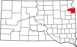
Grant County[1] ist ein County im Osten des Bundesstaates South Dakota der Vereinigten Staaten von Amerika.
Inhaltsverzeichnis
Geographie
Der Bezirk hat eine Fläche von 1782 Quadratkilometern; davon sind 14 Quadratkilometer (0,78 Prozent) Wasserflächen. Er ist in 17 Townships eingeteilt: Adams, Alban, Big Stone, Blooming Valley, Farmington, Georgia, Grant Center, Kilborn, Lura, Madison, Mazeppa, Melrose, Osceola, Stockholm, Troy, Twin Brooks und Vernon.
Bevölkerungsentwicklung
Historische Einwohnerzahlen Census Einwohner ± in % 1900 9103 — 1910 10.303 10 % 1920 10.880 6 % 1930 10.729 -1 % 1940 10.552 -2 % 1950 10.233 -3 % 1960 9913 -3 % 1970 9005 -9 % 1980 9013 0,09 % 1990 8372 -7 % 2000 7847 -6 % 2010 7356 -6 % 1900–1990[2] 2000[3]
Städte und Gemeinden
Städte (cities)
- Big Stone City
- Milbank
Gemeinden (towns)
- Albee
- La Bolt
- Marvin
- Revillo
- Stockholm
- Strandburg
- Twin Brooks
Einzelnachweise
- ↑ Grant County im Geographic Names Information System des United States Geological Survey. Abgerufen am 22. Februar 2011
- ↑ Auszug aus Census.gov. Abgerufen am 28. Februar 2011
- ↑ Auszug aus factfinder.census.gov Abgerufen am 28. Februar 2011
Weblinks
 Commons: Grant County, South Dakota – Sammlung von Bildern, Videos und Audiodateien
Liste der Countys in South Dakota
Aurora | Beadle | Bennett | Bon Homme | Brookings | Brown | Brule | Buffalo | Butte | Campbell | Charles Mix | Clark | Clay | Codington | Corson | Custer | Davison | Day | Deuel | Dewey | Douglas | Edmunds | Fall River | Faulk | Grant | Gregory | Haakon | Hamlin | Hand | Hanson | Harding | Hughes | Hutchinson | Hyde | Jackson | Jerauld | Jones | Kingsbury | Lake | Lawrence | Lincoln | Lyman | Marshall | McCook | McPherson | Meade | Mellette | Miner | Minnehaha | Moody | Pennington | Perkins | Potter | Roberts | Sanborn | Shannon | Spink | Stanley | Sully | Todd | Tripp | Turner | Union | Walworth | Yankton | Ziebach
Wikimedia Foundation.
Schlagen Sie auch in anderen Wörterbüchern nach:
Grant County, South Dakota — Location in the state of South Dakota … Wikipedia
National Register of Historic Places listings in Grant County, South Dakota — Location of Grant County in South Dakota This is a list of the National Register of Historic Places listings in Grant County, South Dakota. This is intended to be a complete list of the properties and districts on the National Register of… … Wikipedia
Mazeppa Township, Grant County, South Dakota — Mazeppa Township located in Grant County, State of South Dakota, United States. The population is 79 people in the 2000 census. 47% of the inhabitants of the village of Mazeppa German origin, and 11% of the Irish, the rest of the Norwegian and… … Wikipedia
Adams Township, Grant County, South Dakota — Infobox Settlement official name = Adams Township, South Dakota settlement type = Township nickname = motto = imagesize = image caption = image mapsize = map caption = mapsize1 = map caption1 = subdivision type = Country subdivision name = United … Wikipedia
Grant County, North Dakota — Location in the state of North Dakota … Wikipedia
Grant County (North Dakota) — Verwaltung US Bundesstaat: North Dakota Verwaltungssitz: Carson Adresse des Verwaltungssitzes: County Courthouse P.O. Box 227 Carson, ND 58529 0227 Gründung: 1916 … Deutsch Wikipedia
Day County, South Dakota — Location in the state of South Dakota … Wikipedia
Deuel County, South Dakota — Location in the state of South Dakota … Wikipedia
Codington County, South Dakota — Location in the state of South Dakota … Wikipedia
Minnehaha County (South Dakota) — Verwaltung US Bundesstaat: South Dakota Verwaltungssitz: Sioux Falls Adresse des Verwaltungssitzes: Gründung … Deutsch Wikipedia
Grant County (South Dakota)

18+
© Academic, 2000-2026
- Kontaktieren Sie uns: Unterstützung, Werbung
Wörterbücher Export, schritte mit PHP, Joomla, Drupal, WordPress, MODx.