- Potter County (South Dakota)
-
Verwaltung US-Bundesstaat: South Dakota Verwaltungssitz: Gettysburg Gründung: 1875 Demographie Einwohner: 2321 (2006) Bevölkerungsdichte: 1 Einwohner/km² Geographie Fläche gesamt: 2.327 km² Wasserfläche: 83 km² Karte 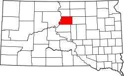
Potter County[1] ist ein County im Bundesstaat South Dakota der Vereinigten Staaten von Amerika. Der Sitz der Countyverwaltung (County Seat) ist in Gettysburg.
Inhaltsverzeichnis
Geographie
Der Bezirk hat eine Fläche von 2327 Quadratkilometern; davon sind 83 Quadratkilometer (3,56 Prozent) Wasserflächen. Er ist in drei unorganisierte Territorien eingeteilt: West Potter, Central Potter und East Potter. Das County grenzt im Uhrzeigersinn an die Countys: Walworth County, Edmunds County, Faulk County, Hyde County, Sully County und Dewey County.
Bevölkerungsentwicklung
Historische Einwohnerzahlen Census Einwohner ± in % 1900 2988 — 1910 4466 50 % 1920 4382 -2 % 1930 5762 30 % 1940 4614 -20 % 1950 4688 2 % 1960 4926 5 % 1970 4449 -10 % 1980 3674 -20 % 1990 3190 -10 % 2000 2693 -20 % 2010 2329 -10 % 1900–1990[2] 2000[3]
Städte und Gemeinden
Städte (cities)
- Gettysburg
Gemeinden (towns)
- Hovern
- Lebanon
- Tolstoy
Einzelnachweise
- ↑ Potter County im Geographic Names Information System des United States Geological Survey. Abgerufen am 22. Februar 2011
- ↑ Auszug aus Census.gov. Abgerufen am 28. Februar 2011
- ↑ Auszug aus factfinder.census.gov Abgerufen am 28. Februar 2011

Liste der Countys in South Dakota
Aurora | Beadle | Bennett | Bon Homme | Brookings | Brown | Brule | Buffalo | Butte | Campbell | Charles Mix | Clark | Clay | Codington | Corson | Custer | Davison | Day | Deuel | Dewey | Douglas | Edmunds | Fall River | Faulk | Grant | Gregory | Haakon | Hamlin | Hand | Hanson | Harding | Hughes | Hutchinson | Hyde | Jackson | Jerauld | Jones | Kingsbury | Lake | Lawrence | Lincoln | Lyman | Marshall | McCook | McPherson | Meade | Mellette | Miner | Minnehaha | Moody | Pennington | Perkins | Potter | Roberts | Sanborn | Shannon | Spink | Stanley | Sully | Todd | Tripp | Turner | Union | Walworth | Yankton | Ziebach
Wikimedia Foundation.
Schlagen Sie auch in anderen Wörterbüchern nach:
Potter County, South Dakota — Infobox U.S. County county = Potter County state = South Dakota founded year = founded date = seat wl = Gettysburg largest city wl = area total sq mi = 898 area total km2 = 2327 area land sq mi =866 area land km2 = 2244 area water sq mi = 32 area … Wikipedia
National Register of Historic Places listings in Potter County, South Dakota — Location of Potter County in South Dakota This is a list of the National Register of Historic Places listings in Potter County, South Dakota. This is intended to be a complete list of the properties on the National Register of Historic Places in… … Wikipedia
Edmunds County, South Dakota — Location in the state of South Dakota … Wikipedia
Dewey County, South Dakota — Location in the state of South Dakota … Wikipedia
Minnehaha County (South Dakota) — Verwaltung US Bundesstaat: South Dakota Verwaltungssitz: Sioux Falls Adresse des Verwaltungssitzes: Gründung … Deutsch Wikipedia
Ziebach County (South Dakota) — Verwaltung US Bundesstaat: South Dakota Verwaltungssitz: Dupree Adresse des Verwaltungssitzes: Gründung … Deutsch Wikipedia
Walworth County, South Dakota — Infobox U.S. County county = Walworth County state = South Dakota founded year = founded date = seat wl = Selby largest city wl = area total sq mi = 744 area total km2 = 1928 area land sq mi = 708 area land km2 = 1833 area water sq mi = 36 area… … Wikipedia
Hyde County, South Dakota — Infobox U.S. County county = Hyde County state = South Dakota founded year = founded date = seat wl = Highmore largest city wl = area total sq mi = 867 area total km2 = 2244 area land sq mi =861 area land km2 = 2230 area water sq mi = 6 area… … Wikipedia
Sully County, South Dakota — Infobox U.S. County county = Sully County state = South Dakota founded year = founded date = seat wl = Onida largest city wl = area total sq mi = 1070 area total km2 = 2772 area land sq mi =1007 area land km2 = 2608 area water sq mi = 63 area… … Wikipedia
Faulk County, South Dakota — Infobox U.S. County county = Faulk County state = South Dakota founded year = founded date = seat wl = Faulkton largest city wl = area total sq mi = 1006 area total km2 = 2605 area land sq mi = 1000 area land km2 = 2590 area water sq mi = 6 area… … Wikipedia
Potter County (South Dakota)

18+
© Academic, 2000-2026
- Kontaktieren Sie uns: Unterstützung, Werbung
Wörterbücher Export, schritte mit PHP, Joomla, Drupal, WordPress, MODx.