- Roberts County (South Dakota)
-
Verwaltung US-Bundesstaat: South Dakota Verwaltungssitz: Sisseton Gründung: 1883 Demographie Einwohner: 10.024 (2006) Bevölkerungsdichte: 3,5 Einwohner/km² Geographie Fläche gesamt: 2.941 km² Wasserfläche: 88 km² Karte 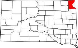
Roberts County[1] ist ein County im Bundesstaat South Dakota der Vereinigten Staaten von Amerika. Der Sitz der Countyverwaltung (County Seat) ist in Sisseton.
Inhaltsverzeichnis
Geographie
Das County hat eine Fläche von 2.941 Quadratkilometern und ist somit etwas größer als das Saarland . Davon sind 88 Quadratkilometer (3,00 Prozent) Wasserfläche.
Bevölkerungsentwicklung
Historische Einwohnerzahlen Census Einwohner ± in % 1900 12.216 — 1910 14.897 20 % 1920 16.514 10 % 1930 15.782 -4 % 1940 15.887 0,7 % 1950 14.929 -6 % 1960 13.190 -10 % 1970 11.678 -10 % 1980 10.911 -7 % 1990 9914 -9 % 2000 10.016 1 % 2010 10.149 1 % 1900–1990[2] 2000[3]
Städte und Gemeinden
Städte (cities)
Gemeinden (towns)
- Claire City
- Corona
- Hammer
- New Effington
- Ortley
- Peever
- Rosholt
- Summit
- Victor
- White Rock
Townships
Roberts County ist ein 30 Townships eingeteilt: Agency, Alto, Becker, Bossko, Bryant, Dry Wood Lake, Easter, Enterprise, Garfield, Geneseo, Goodwill, Grant, Harmon, Hart, Lake, Lawrence, Lee, Lien, Lockwood, Long Hollow, Minnesota, Norway, One Road, Ortley, Sisseton, Springdale, Spring Grove, Summit, Victor und White Rock.
Einzelnachweise
- ↑ Roberts County im Geographic Names Information System des United States Geological Survey. Abgerufen am 22. Februar 2011
- ↑ Auszug aus Census.gov. Abgerufen am 28. Februar 2011
- ↑ Auszug aus factfinder.census.gov Abgerufen am 28. Februar 2011

Liste der Countys in South Dakota
Aurora | Beadle | Bennett | Bon Homme | Brookings | Brown | Brule | Buffalo | Butte | Campbell | Charles Mix | Clark | Clay | Codington | Corson | Custer | Davison | Day | Deuel | Dewey | Douglas | Edmunds | Fall River | Faulk | Grant | Gregory | Haakon | Hamlin | Hand | Hanson | Harding | Hughes | Hutchinson | Hyde | Jackson | Jerauld | Jones | Kingsbury | Lake | Lawrence | Lincoln | Lyman | Marshall | McCook | McPherson | Meade | Mellette | Miner | Minnehaha | Moody | Pennington | Perkins | Potter | Roberts | Sanborn | Shannon | Spink | Stanley | Sully | Todd | Tripp | Turner | Union | Walworth | Yankton | Ziebach
Wikimedia Foundation.
Schlagen Sie auch in anderen Wörterbüchern nach:
Roberts County, South Dakota — Infobox U.S. County county = Roberts County state = South Dakota founded year = 1883 [ Legislative Manual, South Dakota, 2005, p. 597] founded date = seat wl = Sisseton largest city wl = area total sq mi = 1135 area total km2 = 2941 area land sq… … Wikipedia
National Register of Historic Places listings in Roberts County, South Dakota — Location of Roberts County in South Dakota This is a list of the National Register of Historic Places listings in Roberts County, South Dakota. This is intended to be a complete list of the properties and districts on the National Register of… … Wikipedia
Agency Township, Roberts County, South Dakota — Infobox Settlement official name = Agency Township, South Dakota settlement type = Township nickname = motto = imagesize = image caption = image mapsize = map caption = mapsize1 = map caption1 = subdivision type = Country subdivision name =… … Wikipedia
Marshall County, South Dakota — Location in the state of South Dakota … Wikipedia
Grant County, South Dakota — Location in the state of South Dakota … Wikipedia
Day County, South Dakota — Location in the state of South Dakota … Wikipedia
Minnehaha County (South Dakota) — Verwaltung US Bundesstaat: South Dakota Verwaltungssitz: Sioux Falls Adresse des Verwaltungssitzes: Gründung … Deutsch Wikipedia
Ziebach County (South Dakota) — Verwaltung US Bundesstaat: South Dakota Verwaltungssitz: Dupree Adresse des Verwaltungssitzes: Gründung … Deutsch Wikipedia
Clay County, South Dakota — Location in the state of South Dakota … Wikipedia
Minnehaha County, South Dakota — Minnehaha County Courthouse in Sioux Falls, South Dakota … Wikipedia
Roberts County (South Dakota)

18+
© Academic, 2000-2026
- Kontaktieren Sie uns: Unterstützung, Werbung
Wörterbücher Export, schritte mit PHP, Joomla, Drupal, WordPress, MODx.