- Clay County (South Dakota)
-
Verwaltung US-Bundesstaat: South Dakota Verwaltungssitz: Vermillion Gründung: 1862 Demographie Einwohner: 13.537 (2000) Bevölkerungsdichte: 12,7 Einwohner/km² Geographie Fläche gesamt: 1.079 km² Wasserfläche: 13 km² Karte 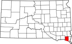
Clay County[1] ist ein Bezirk im Bundesstaat South Dakota der Vereinigten Staaten von Amerika.
Inhaltsverzeichnis
Geographie
Der Bezirk hat eine Fläche von 1.079 Quadratkilometern; davon sind 13 Quadratkilometer (1,22 Prozent) Wasserflächen. Er ist in 12 Townships eingeteilt: Bethel, Fairview Garfield, Glenwood, Meckling, Norway, Pleasant Valley, Prairie Center, Riverside, Spirit Mound, Star, Vermillion.
Bevölkerungsentwicklung
Historische Einwohnerzahlen Census Einwohner ± in % 1900 9316 — 1910 8711 -6 % 1920 9654 10 % 1930 10.088 4 % 1940 9592 -5 % 1950 10.993 10 % 1960 10.810 -2 % 1970 12.923 20 % 1980 13.689 6 % 1990 13.186 -4 % 2000 13.537 3 % 2010 13.864 2 % 1900–1990[2] 2000[3]
Städte und Gemeinden
Städte (cities)
- Irene
- Vermillion
Gemeinden (towns)
- Wakonda
- Burbank
- Dalesburg
- Greenfield
- Meckling
- Westreville
Einzelnachweise
- ↑ Clay County im Geographic Names Information System des United States Geological Survey. Abgerufen am 22. Februar 2011
- ↑ Auszug aus Census.gov. Abgerufen am 28. Februar 2011
- ↑ Auszug aus factfinder.census.gov Abgerufen am 28. Februar 2011

Liste der Countys in South Dakota
Aurora | Beadle | Bennett | Bon Homme | Brookings | Brown | Brule | Buffalo | Butte | Campbell | Charles Mix | Clark | Clay | Codington | Corson | Custer | Davison | Day | Deuel | Dewey | Douglas | Edmunds | Fall River | Faulk | Grant | Gregory | Haakon | Hamlin | Hand | Hanson | Harding | Hughes | Hutchinson | Hyde | Jackson | Jerauld | Jones | Kingsbury | Lake | Lawrence | Lincoln | Lyman | Marshall | McCook | McPherson | Meade | Mellette | Miner | Minnehaha | Moody | Pennington | Perkins | Potter | Roberts | Sanborn | Shannon | Spink | Stanley | Sully | Todd | Tripp | Turner | Union | Walworth | Yankton | Ziebach

Wikimedia Foundation.