- Nyamira District
-
Nyamira District Basisdaten Einwohner
- Bevölkerungsdichte498.102 Einw. [1]
556 Einw./km²Fläche 896 km² Koordinaten 0° 45′ S, 35° 0′ O-0.7535Koordinaten: 0° 45′ S, 35° 0′ O 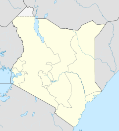

Nyamira District Politik Provinz Nyanza Nyamira District ist ein Distrikt in der Provinz Nyanza in Kenia. Die Distriktshauptstadt ist Nyamira. Der Nyamira District unterteilt sich in sieben Divisionen: Nyamira, Nyamaiya, Nyamusi, Borabu, Ekerenyo, Rigoma und Manga. Nyamira District ist in vier Wahlbezirke aufgeteilt. 67 % der Menschen im Nyamira District lebten 2005 unterhalb der Armutsgrenze.[2]
Bildung
Der Distrikt verfügt über 339 Primary Schools und 58 Secondary Schools. 15 % der Jungen und 20 % der Mädchen beenden die Primary School nicht, in der Secondary School brechen 20 % der Schüler die Schulausbildung vorzeitig ab.[3]
Gesundheitswesen
Der Bevölkerung stehen zwei Krankenhäuser und 21 Gesundheitszentren zur Verfügung. Auf einen Arzt kommen 65.000 Patienten, die Krankenhausbetten sind im Schnitt zu 65 % mit HIV-positiven oder an Aids erkrankten Menschen belegt. Neben der Immunschwächekrankheit werden hauptsächlich Malaria, Atemwegserkrankungen und Pneumonien sowie Hautkrankheiten behandelt. Die Säuglingssterblichkeit lag 2005 bei 8 %, 10,5 % der Kinder starben vor ihrem 5. Geburtstag.[2]
Einzelnachweise
- ↑ statoids.com, abgerufen am 22. November 2010.
- ↑ a b Nyamira District Strategic Plan 2005–2010 (pdf), S. 15; abgerufen am 22. November 2010.
- ↑ Nyamira District Strategic Plan 2005–2010 (pdf), S. 14; abgerufen am 22. November 2010.
 Distrikte in Kenia
Central Province: Kiambu | Kirinyaga | Maragua | Murang’a | Nyandarua | Nyeri | Thika
Coast Province: Kilifi | Kwale | Lamu | Malindi | Mombasa | Taita-Taveta | Tana River
Eastern Province: Embu | Isiolo | Kitui | Machakos | Makueni | Marsabit | Mbeere | Meru Central | Meru North | Meru South | Moyale | Mwingi | Tharaka
North-Eastern Province: Garissa | Ijara | Wajir | Mandera
Nyanza Province: Bondo | Gucha | Homa Bay | Kisii Central | Kisumu | Kuria | Migori | Nyamira | Nyando | Rachuonyo | Siaya | Suba
Rift Valley Province: Baringo | Bomet | Buret | Kajiado | Keiyo | Kericho | Koibatek | Laikipia | Marakwet | Nakuru | Nandi | Narok | Samburu | Trans Mara | Trans-Nzoia | Turkana | Uasin Gishu | West Pokot
Western Province: Bungoma | Busia | Butere/Mumias | Kakamega | Lugari | Mount Elgon | Teso | Vihiga
Nairobi: Nairobi
Wikimedia Foundation.
Schlagen Sie auch in anderen Wörterbüchern nach:
Nyamira District — is an administrative district in the Nyanza Province of Kenya. It was formerly part of the Kisii District and is sometimes called as North Kisii District. The district has a population of 492,102 (1999 census). Its capital town is Nyamira, with… … Wikipedia
Nyamira District — Admin ASC 1 Code Orig. name Nyamira Country and Admin Code KE.42 KE … World countries Adminstrative division ASC I-II
Nyamira — Administration Pays Kenya … Wikipédia en Français
Nyamira — Coordinates: 0°31′16″S 34°54′50″E / 0.521°S 34.914°E / 0.521; 34.914 Nyamira is a town in the Nyanza Province of K … Wikipedia
Nyamira (comté du Kenya) — 0° 33′ 53″ S 34° 55′ 59″ E / 0.564649, 34.933000 … Wikipédia en Français
Kisii Central District — Basisdaten Einwohner Bevölkerungsdichte 491.786 Einw. 758 Einw./km² Fläche 649 km² Koordinaten … Deutsch Wikipedia
Kisii District — is one of the twelve districts of Nyanza Province in southwest Kenya, and is divided into five local authorities and eleven administrative districts. The district capital is Kisii. The district is mostly hilly and is dissected by rivers flowing… … Wikipedia
Bondo District — Basisdaten Einwohner Bevölkerungsdichte 238.780 Einw. [1] 242 Einw./km² Fläche 987 km² Koordinaten … Deutsch Wikipedia
Meru South District — Basisdaten Einwohner Bevölkerungsdichte 205.451 Einw. 188 Einw./km² Fläche 1093 km² Koordinaten … Deutsch Wikipedia
Murang’a District — Basisdaten Einwohner Bevölkerungsdichte 348.304 Einw. [1] 375 Einw./km² Fläche 930 km² Koordinaten … Deutsch Wikipedia
Nyamira District

18+
© Academic, 2000-2024
- Kontaktieren Sie uns: Unterstützung, Werbung
Wörterbücher Export, schritte mit PHP, Joomla, Drupal, WordPress, MODx.