- Samburu District
-
Samburu District Basisdaten Einwohner
- Bevölkerungsdichte143.547 Einw. [1]
7 Einw./km²Fläche 21.127 km² Koordinaten 1° 10′ N, 36° 40′ O1.166666666666736.666666666667Koordinaten: 1° 10′ N, 36° 40′ O 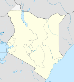

Samburu District Politik Provinz Rift Valley Samburu District ist ein Distrikt in der kenianischen Provinz Rift Valley. Die Hauptstadt des Distriktes ist Maralal. Im Distrikt lebten 1999 143.547 Menschen auf 21.000 km². Der Distrikt gehört zu den trockensten Gebieten Kenias, die Menschen leben hauptsächlich von nomadischer Viehhaltung.[2]
Der Distrikt erstreckt sich vom Uaso Nyiro zum Südufer des Turkana-Sees. Im Distrikt liegen das Samburu National Reserve und Teile des Buffalo-Springs-Nationalreservats. Samburu District verfügt über ein 1400 km großes Straßennetz, allerdings ist keine Straße geteert.[2] Nur vier der sechs Divisionshauptstädte verfügen über einen Telefonanschluss. Im District Samburu gibt es nur vier Postämter.[2]
Gliederung
Der Distrikt teilt sich in Councils und Divisionen auf. Es gibt zwei Wahlbezirke, Samburu East und Samburu West.
Councils Sitz der Behörde Typ Einwohner[3] Maralal Stadt 24.612 Samburu County 118.935 Gesamt - 143.547 Divisionen Division Einwohner[3] Hauptstadt Baragoi 19.884 Baragoi Kirisia 47.072 Mararal Lorroki 25.571 Nyiro 15.551 Wamba 24.155 Wamba Waso 10.314 Gesamt 143.547 - Einzelnachweise
- ↑ statoids.com, abgerufen am 15. Februar 2010.
- ↑ a b c kenyafoodsecurity.org (pdf), abgerufen am 19. Februar 2010.
- ↑ a b Statistik auf cck.go.ke (pdf), abgerufen am 19. Februar 2010.
 Distrikte in Kenia
Central Province: Kiambu | Kirinyaga | Maragua | Murang’a | Nyandarua | Nyeri | Thika
Coast Province: Kilifi | Kwale | Lamu | Malindi | Mombasa | Taita-Taveta | Tana River
Eastern Province: Embu | Isiolo | Kitui | Machakos | Makueni | Marsabit | Mbeere | Meru Central | Meru North | Meru South | Moyale | Mwingi | Tharaka
North-Eastern Province: Garissa | Ijara | Wajir | Mandera
Nyanza Province: Bondo | Gucha | Homa Bay | Kisii Central | Kisumu | Kuria | Migori | Nyamira | Nyando | Rachuonyo | Siaya | Suba
Rift Valley Province: Baringo | Bomet | Buret | Kajiado | Keiyo | Kericho | Koibatek | Laikipia | Marakwet | Nakuru | Nandi | Narok | Samburu | Trans Mara | Trans-Nzoia | Turkana | Uasin Gishu | West Pokot
Western Province: Bungoma | Busia | Butere/Mumias | Kakamega | Lugari | Mount Elgon | Teso | Vihiga
Nairobi: Nairobi
Wikimedia Foundation.
Schlagen Sie auch in anderen Wörterbüchern nach:
Samburu District — is a district in Rift Valley Province, Kenya. It covers an area of roughly 21,000 km² (8,000 mi²) in northern Kenya where the Samburu tribe live. It stretches north from the Wuaso Ng iro River to the south of Lake Turkana and also includes Mount… … Wikipedia
Samburu — Infobox Ethnic group group=Samburu image caption=Samburu people making fire poptime= popplace=north central Kenya rels=African traditional religion langs=Samburu language related=Maasai: Samburu may also refer to Samburu National Reserve or… … Wikipedia
Samburu National Reserve — Infobox protected area name = Samburu National Reserve iucn category = II caption = Location of Samburu National Reserve base width = 300px locator x = 135 locator y = 143 location = Kenya, Rift Valley Province nearest city = lat degrees = 0 lat… … Wikipedia
Samburu language — language name=Samburu nativename=Sampur, IPA|ɔl Maa familycolor=Nilo Saharan states=Kenya region=Samburu district of Rift Valley Province speakers=128,000 (147,000 including the Camus) fam2=Eastern Saharan fam3=Eastern Nilotic fam4=Lotuxo Teso… … Wikipedia
Samburu Project — The Samburu Project (TSP) is a non profit organization based in Santa Monica, California and founded in the Fall of 2005 [Fleming Morgans S: The Samburu Project: 25 Wells . MTL Magazine , Apr 2006. p66.] by Kristen Kosinski, a former television… … Wikipedia
Kwale District — is an administrative district in the Coast Province of Kenya. Its capital town is Kwale, although Msabweni and Ukunda are larger.The district has a population of 496.133 [http://www.cck.go.ke/html/final annex1 cover status.pdf] .Kwale is mainly… … Wikipedia
Turkana District — is an administrative district in the Rift Valley Province of Kenya. Turkana is the northwesternmost district in Kenya. It has an international border with three countries: Uganda, Sudan and Ethiopia. Its neighbouring districts in Kenya are West… … Wikipedia
Meru South District — Basisdaten Einwohner Bevölkerungsdichte 205.451 Einw. 188 Einw./km² Fläche 1093 km² Koordinaten … Deutsch Wikipedia
Murang’a District — Basisdaten Einwohner Bevölkerungsdichte 348.304 Einw. [1] 375 Einw./km² Fläche 930 km² Koordinaten … Deutsch Wikipedia
Bondo District — Basisdaten Einwohner Bevölkerungsdichte 238.780 Einw. [1] 242 Einw./km² Fläche 987 km² Koordinaten … Deutsch Wikipedia
Samburu District

18+
© Academic, 2000-2026
- Kontaktieren Sie uns: Unterstützung, Werbung
Wörterbücher Export, schritte mit PHP, Joomla, Drupal, WordPress, MODx.