- Homa Bay District
-
Homa Bay District Basisdaten Einwohner
- Bevölkerungsdichte288.540 Einw.
249 Einw./km²Fläche 1160 km² Koordinaten 0° 41′ S, 34° 27′ O-0.6833333333333334.45Koordinaten: 0° 41′ S, 34° 27′ O 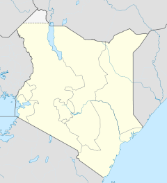

Homa Bay District Politik Provinz Nyanza Der Distrikt Homa Bay ist ein Bezirk in der Provinz Nyanza in Kenia. Die Hauptstadt des Distrikts ist Homa Bay. Im Distrikt lebten 1999 288.540 Menschen auf 1160 km².[1] 2,7% der Haushalte sind an das Stromnetz angeschlossen.[2] Der Distrikt grenzt an den Victoriasee. Im Bezirk liegt der Ruma-Nationalpark.
Gliederung
Der Distrikt Homa Bay gliedert sich in zwei Councils und fünf Divisionen. Es gibt zwei Wahlbezirke namens Ndhiwa und Rangwe.
Councils Sitz der Behörde Art Einwohner[2] Homa Bay Stadtgemeinde 55.532 Homa Bay County County 233.008 Gesamt - 288.540 Divisionen Division Einwohner[2] Hauptstadt Asego 76.778 Homa Bay Ndhiwa 43.231 Nyarongi 41.300 Rangwe 79.263 Rangwe Riana 47.968 Gesamt 288.540 - Religion
Der Distrikt Homa Bay ist Sitz der Diözese Homa Bay der römisch-katholischen Kirche. Die Diözese Homa Bay wurde 1993 gegründet. Bischof der Diözese ist seit 2003 Philip Anyolo.[3]
Einzelnachweise
- ↑ statoids.com – Districts of Kenya, abgerufen am 10. Dezember 2009.
- ↑ a b c Statistik auf cck.go.ke (pdf), abgerufen am 10. Dezember 2009.
- ↑ Diözese Homa Bay auf der Homepage der katholischen Kirche in Kenia, abgerufen am 10. Dezember 2009.
 Distrikte in Kenia
Central Province: Kiambu | Kirinyaga | Maragua | Murang’a | Nyandarua | Nyeri | Thika
Coast Province: Kilifi | Kwale | Lamu | Malindi | Mombasa | Taita-Taveta | Tana River
Eastern Province: Embu | Isiolo | Kitui | Machakos | Makueni | Marsabit | Mbeere | Meru Central | Meru North | Meru South | Moyale | Mwingi | Tharaka
North-Eastern Province: Garissa | Ijara | Wajir | Mandera
Nyanza Province: Bondo | Gucha | Homa Bay | Kisii Central | Kisumu | Kuria | Migori | Nyamira | Nyando | Rachuonyo | Siaya | Suba
Rift Valley Province: Baringo | Bomet | Buret | Kajiado | Keiyo | Kericho | Koibatek | Laikipia | Marakwet | Nakuru | Nandi | Narok | Samburu | Trans Mara | Trans-Nzoia | Turkana | Uasin Gishu | West Pokot
Western Province: Bungoma | Busia | Butere/Mumias | Kakamega | Lugari | Mount Elgon | Teso | Vihiga
Nairobi: Nairobi

Wikimedia Foundation.