- Kisumu District
-
Kisumu District Basisdaten Einwohner
- Bevölkerungsdichte504.359 Einw.
549 Einw./km²Fläche 919 km² Koordinaten 0° 5′ S, 34° 45′ O-0.08333333333333334.75Koordinaten: 0° 5′ S, 34° 45′ O 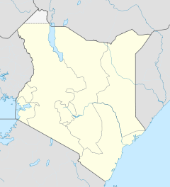

Kisumu District Politik Provinz Nyanza Kisumu District ist ein Distrikt in der Provinz Nyanza in Kenia. Die Distriktshauptstadt ist Kisumu. 1999 lebten knapp 504.000 Menschen dort auf 919 km².[1][2] 13,9% der Haushalte sind an das Stromnetz angeschlossen.[1] Der Distrikt liegt am Ostufer des Victoriasees und lebt hauptsächlich von Subsistenzwirtschaft und Fischerei. Die Alphabetisierungsrate lag 1996 bei 28 % der weiblichen Bevölkerung, von der männlichen Bevölkerung waren 31 % des Lesens und Schreibens mächtig.[3]
Gliederung
Der Distrikt Kisumu ist in vier Divisionen unterteilt. Es gibt drei Wahlbezirke im Distrikt, Kisumu Town East, Kisumu Town West und Kisumu Rural.
Divisionen Division Einwohner[1] Hauptstadt Kadibo 48.934 Rabuor Kombewa 60.183 Maseno 65.304 Maseno Winam 329.958 Kisumu Einzelnachweise
- ↑ a b c Statistik auf cck.go.ke (pdf), abgerufen am 9. Dezember 2009.
- ↑ statoids.com – Districts of Kenya, abgerufen am 9. Dezember 2009.
- ↑ Beth Blue Swadener mit Margaret Kibaru und Anne Njenga: Does the Village Still Raise the Child?, State University of New York Press, 2000; S. 239/240. Hier online bei books.google, abgerufen am 12. Dezember 2009.
 Distrikte in Kenia
Central Province: Kiambu | Kirinyaga | Maragua | Murang’a | Nyandarua | Nyeri | Thika
Coast Province: Kilifi | Kwale | Lamu | Malindi | Mombasa | Taita-Taveta | Tana River
Eastern Province: Embu | Isiolo | Kitui | Machakos | Makueni | Marsabit | Mbeere | Meru Central | Meru North | Meru South | Moyale | Mwingi | Tharaka
North-Eastern Province: Garissa | Ijara | Wajir | Mandera
Nyanza Province: Bondo | Gucha | Homa Bay | Kisii Central | Kisumu | Kuria | Migori | Nyamira | Nyando | Rachuonyo | Siaya | Suba
Rift Valley Province: Baringo | Bomet | Buret | Kajiado | Keiyo | Kericho | Koibatek | Laikipia | Marakwet | Nakuru | Nandi | Narok | Samburu | Trans Mara | Trans-Nzoia | Turkana | Uasin Gishu | West Pokot
Western Province: Bungoma | Busia | Butere/Mumias | Kakamega | Lugari | Mount Elgon | Teso | Vihiga
Nairobi: Nairobi
Wikimedia Foundation.
Schlagen Sie auch in anderen Wörterbüchern nach:
Kisumu District — is an administrative district of Nyanza Province in western Kenya. Its headquarters is Kisumu City. It has a population of 504,359 (as of 1999) and a land area of 919 km² [http://www.statoids.com/yke.html] . The main industries are subsistence… … Wikipedia
Kisumu (district du Kenya) — 0° 05′ 00″ S 34° 45′ 00″ E / 0.08333333, 34.75 … Wikipédia en Français
Kisumu — La rue la plus commerçante : Oginga Odinga street Administration … Wikipédia en Français
Kisumu Rural Constituency — is an electoral constituency in Kenya. It is one of three constituencies of Kisumu District. The constituency was established for the 1963 elections. The constituency has eight wards, all of which elect councillors for Kisumu County Council.The… … Wikipedia
Kisumu (comté du Kenya) — 0° 06′ 07″ S 34° 45′ 06″ E / 0.101944, 34.751667 … Wikipédia en Français
Kisumu — Infobox Settlement official name = Kisumu, Kenya image caption = View of Jomo Kenyatta Sports Ground in Kisumu flag size = pushpin dot mapsize = subdivision type = Country subdivision type1 = Province subdivision type2 = District subdivision name … Wikipedia
Nyando District — is a fairly new district in Kenya which broke away from Kisumu District in Nyanza Province in 1998. Nyando district borders the Rift Valley Province. The district is named after the Nyando River. Its capital is in a small town called Awasi,… … Wikipedia
Nyando District — Basisdaten Einwohner Bevölkerungsdichte 299.930 Einw. [1] 257 Einw./km² Fläche 1168 km² Koordinaten … Deutsch Wikipedia
Siaya District — is one of the twelve districts that make up Nyanza Province in the southwest part of Kenya. It is bordered by Busia District to the North, Vihiga and Butere/Mumias Districts to the North East, Bondo District to the South, and Kisumu District to… … Wikipedia
Nyando (district du Kenya) — 0° 17′ 00″ S 35° 07′ 00″ E / 0.28333333, 35.11666667 … Wikipédia en Français
Kisumu District

18+
© Academic, 2000-2026
- Kontaktieren Sie uns: Unterstützung, Werbung
Wörterbücher Export, schritte mit PHP, Joomla, Drupal, WordPress, MODx.