- West Pokot District
-
West Pokot District Basisdaten Einwohner
- Bevölkerungsdichte308.086 Einw. [1]
34 Einw./km²Fläche 9064 km² Koordinaten 1° 14′ N, 35° 7′ O1.233333333333335.116666666667Koordinaten: 1° 14′ N, 35° 7′ O 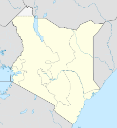

West Pokot District Politik Provinz Rift Valley West Pokot District ist ein Distrikt in der kenianischen Provinz Rift Valley. Die Hauptstadt des Distriktes ist Kapenguria. Im Distrikt lebten 1999 308.086 Menschen auf 9.064 km². West Pokot grenzt im Westen an Uganda. Die Menschen leben hauptsächlich von Landwirtschaft, knapp 14 % der Landfläche sind urbar, Wälder nehmen 3,8 % des Distriktsgebietes ein.[2] Angebaut werden vor allem Mais, Bohnen und Hirse.[3] Im West Pokot District befindet sich die Turkwel-Talsperre.
Inhaltsverzeichnis
Bildung
2003 gab es 250 Primary Schools und nur 15 Secondary Schools in West Pokot, deren Gebäude sich teilweise in einem sehr schlechten Zustand befanden.[4] 2006 war die Zahl der Primary Schools auf 304 angewachsen, die Zahl der Secondary Schools auf 26. Alle Primary Schools nahmen an einem Schulspeisungsprogramm teil.[3]
Gesundheitswesen
Die medizinische Versorgung im West Pokot District ist schlecht, es gibt nur zwei Krankenhäuser. In Kapenguria befindet sich das Kapenguria District Hospital, in Ortum ein 1956 gegründetes Missionskrankenhaus mit Krankenpflegeschule. Das 125-Betten-Haus wird von der Diözese Kitale betreut.[5]
Gliederung
Der Distrikt teilt sich in Councils und Divisionen auf. Es gibt drei Wahlbezirke, Kacheliba, Kapenguria und Sigor.
Councils Sitz der Behörde Typ Einwohner[6] Kapenguria Gemeinde 56.019 Chepareria Stadt 8.212 Pokot County 243.855 Gesamt - 308.086 Divisionen Division Einwohner[6] Hauptstadt Alale 29.679 Chepareria 68.518 Chepareria Chesegon 21.343 Kacheliba 20.151 Kapenguria 62.746 Kapenguria Kasei 9.879 Kongelai 20.018 Kongelai Lelan 32.931 Sigor 42.821 Sigor Gesamt 308.086 - Einzelnachweise
- ↑ statoids.com, abgerufen am 24. Februar 2010.
- ↑ kenyafoodsecurity.com, abgerufen am 24. Februar 2010.
- ↑ a b Short Rains Assessment 2006, auf kenyafoodsecurity.org, abgerufen am 24. Februar 2010.
- ↑ Susan Mwangi: No fees, but education is still dear in West Pokot, Homepage des African Women and Child Feature Service, abgerufen am 24. Februar 2010.
- ↑ pfarrekagran.at, abgerufen am 24. Februar 2010.
- ↑ a b Statistik auf cck.go.ke (pdf), abgerufen am 24. Februar 2010.
 Distrikte in Kenia
Central Province: Kiambu | Kirinyaga | Maragua | Murang’a | Nyandarua | Nyeri | Thika
Coast Province: Kilifi | Kwale | Lamu | Malindi | Mombasa | Taita-Taveta | Tana River
Eastern Province: Embu | Isiolo | Kitui | Machakos | Makueni | Marsabit | Mbeere | Meru Central | Meru North | Meru South | Moyale | Mwingi | Tharaka
North-Eastern Province: Garissa | Ijara | Wajir | Mandera
Nyanza Province: Bondo | Gucha | Homa Bay | Kisii Central | Kisumu | Kuria | Migori | Nyamira | Nyando | Rachuonyo | Siaya | Suba
Rift Valley Province: Baringo | Bomet | Buret | Kajiado | Keiyo | Kericho | Koibatek | Laikipia | Marakwet | Nakuru | Nandi | Narok | Samburu | Trans Mara | Trans-Nzoia | Turkana | Uasin Gishu | West Pokot
Western Province: Bungoma | Busia | Butere/Mumias | Kakamega | Lugari | Mount Elgon | Teso | Vihiga
Nairobi: Nairobi
Wikimedia Foundation.
Schlagen Sie auch in anderen Wörterbüchern nach:
West Pokot District — is an administrative district in the Rift Valley Province of Kenya. Its capital town is Kapenguria. The district has a population of 308,086 (1999 census) and an area of 9,064 km² [http://www.statoids.com/yke.html] . Pokot people inhabit the area … Wikipedia
Pokot — The Pokot people (commonly spelled Pökoot , and called Suk in older literature) live in the West Pokot and Baringo Districts of Kenya and in eastern Karamoja in Uganda. They speak Pökoot, language of the Southern Nilotic language family. A 1994… … Wikipedia
Meru North District — is one of the seventy one districts of Kenya, located in that country s Eastern Province. In 1992, it was split from the large Meru District, along with Meru Central District, Meru South District, and Tharaka District. Meru North District is the… … Wikipedia
Vihiga District — Basisdaten Einwohner Bevölkerungsdichte 498.883 Einw. [1] 886 Einw./km² Fläche 563 km² Koordinaten … Deutsch Wikipedia
Meru Central District — is one of the seventy one districts of Kenya, located in that country s Eastern Province. In 1992, it was split from the large Meru District, along with Meru North District, Meru South District, and Tharaka District. Meru Central District is the… … Wikipedia
Migori District — Basisdaten Einwohner Bevölkerungsdichte 514.897 Einw. [1] 24 Einw./km² Fläche 21.505 km² Koordinaten … Deutsch Wikipedia
Mombasa District — District … Wikipedia
Marakwet District — is an administrative district in the Rift Valley Province of Kenya. Its capital town is Kapsowar. The district has a population of 140.629 [1]. Local people are predominantly of the Marakwet tribe. The district was created in 1927 as… … Wikipedia
Nyamira District — is an administrative district in the Nyanza Province of Kenya. It was formerly part of the Kisii District and is sometimes called as North Kisii District. The district has a population of 492,102 (1999 census). Its capital town is Nyamira, with… … Wikipedia
Nyandarua District — is an administrative district in the Central Province of Kenya. Its capital town is Ol Kalou. Formerly the capital was Nyahururu, but it is now part of the Laikipia District. Nyandarua District has population of 479,902 and an area of 3,304 km²… … Wikipedia
West Pokot District

18+
© Academic, 2000-2024
- Kontaktieren Sie uns: Unterstützung, Werbung
Wörterbücher Export, schritte mit PHP, Joomla, Drupal, WordPress, MODx.