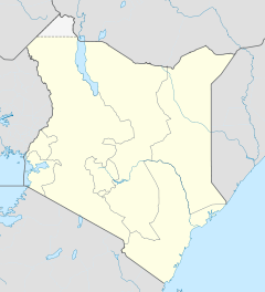
- Garissa District
-
Garissa District Basisdaten Einwohner
- Bevölkerungsdichte517.789 Einw. [1]
15 Einw./km²Fläche 34.389 km² Koordinaten 0° 27′ N, 39° 39′ O0.4569444444444439.658333333333Koordinaten: 0° 27′ N, 39° 39′ O Politik Provinz North-Eastern Garissa District ist ein Distrikt in der kenianischen Provinz North-Eastern. Die Hauptstadt des Distriktes ist Garissa. Im Distrikt lebten 2008 517.789 Menschen auf 34.389 km².[2] Im District herrscht arides Klima, die Temperaturen liegen zwischen 33° und 42°C. Die Menschen im Garissa District leben hauptsächlich von nomadischer Viehhaltung, nur 1 % der Distriktsfläche gilt als landwirtschaftlich nutzbar. Angebaut werden vor allem Bananen, Mangos und Zitronen. 2005 lebten 62 % der Einwohner unterhalb der Armutsgrenze, ungefähr 80 % sind Analphabeten. Die Kindersterblichkeit im Distrikt ist hoch, in den Städten starben im Jahr 2002 8,9 % der Kinder vor ihrem 5. Geburtstag, auf dem Land erlebten 14,6 % der Kinder den 5. Geburtstag nicht.[3]
Verkehr und Infrastruktur
Garissa verfügt über ein Straßennetz von insgesamt 1500 km, 10 % der Straßen sind geteert. Es gibt insgesamt 17 größere Handelszentren im Distrikt, nur eines davon verfügt über elektrischen Strom. Der Distrikt verfügt über 29 Gesundheitseinrichtungen, drei Postämter und sieben Banken.[3]
Gliederung
Der Distrikt teilt sich in elf Divisionen auf. Es gibt drei Wahlbezirke.
Divisionen Division Einwohner[4] Hauptstadt Balambala 13.071 Benane 13.381 Benane Bura 13.009 Central 70.791 Garissa Dadaab 103.671 Dadaab Danyere 8.652 Jarajila 50.455 Liboi 17.140 Liboi Modogashe 14.656 Mado Gashi Sankuri 11.713 Shant-Abak 13.329 Gesamt 329.868 - Einzelnachweise
- ↑ kenyafoodsecurity (pdf), abgerufen am 5. März 2010.
- ↑ District report auf kenyafoodsecurity (pdf), abgerufen am 5. März 2010.
- ↑ a b District profile auf kenyafoodsecurity (pdf), abgerufen am 6. März 2010.
- ↑ Statistik auf cck.go.ke (pdf), abgerufen am 5. März 2010.
Distrikte in KeniaCentral Province: Kiambu | Kirinyaga | Maragua | Murang’a | Nyandarua | Nyeri | Thika
Coast Province: Kilifi | Kwale | Lamu | Malindi | Mombasa | Taita-Taveta | Tana River
Eastern Province: Embu | Isiolo | Kitui | Machakos | Makueni | Marsabit | Mbeere | Meru Central | Meru North | Meru South | Moyale | Mwingi | Tharaka
North-Eastern Province: Garissa | Ijara | Wajir | Mandera
Nyanza Province: Bondo | Gucha | Homa Bay | Kisii Central | Kisumu | Kuria | Migori | Nyamira | Nyando | Rachuonyo | Siaya | Suba
Rift Valley Province: Baringo | Bomet | Buret | Kajiado | Keiyo | Kericho | Koibatek | Laikipia | Marakwet | Nakuru | Nandi | Narok | Samburu | Trans Mara | Trans-Nzoia | Turkana | Uasin Gishu | West Pokot
Western Province: Bungoma | Busia | Butere/Mumias | Kakamega | Lugari | Mount Elgon | Teso | Vihiga
Nairobi: Nairobi
Wikimedia Foundation.

