- Wajir District
-
Wajir District Basisdaten Einwohner
- Bevölkerungsdichte319.261 Einw. [1]
6 Einw./km²Fläche 55.501 km² Koordinaten 1° 45′ N, 40° 4′ O1.747222222222240.068888888889Koordinaten: 1° 45′ N, 40° 4′ O 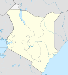

Wajir District Politik Provinz North-Eastern Wajir District ist ein Distrikt in der kenianischen Provinz North-Eastern. Die Hauptstadt des Distriktes ist Wajir. Im Distrikt lebten 1999 319.261 Menschen auf 55.501 km². Der Distrikt grenzt im Norden an Äthiopien. Im Distrikt herrscht ein arides Klima. Die Bodenbeschaffenheit ist größtenteils sehr steinig, im Norden gibt es aber fruchtbare Lehmböden. 30 % der Fläche sind urbar.[2] Die Menschen im Wajir District leben hauptsächlich von nomadischer Viehhaltung. Nur 40 % der Bevölkerung hat Zugang zu sicheren Wasserquellen, die durchschnittlich zurückzulegende Distanz zur nächsten Quelle beträgt 15 km. Im Jahr 2005 lebten mehr als zwei Drittel der Einwohner unterhalb der Armutsgrenze. [2]
Verkehr und Infrastruktur
Das Straßennetz im Distrikt befindet sich in einem schlechten Zustand, nur 7 % der Straßen sind geteert, viele Straßen sind während der Regenzeit unpassierbar. Elektrischen Strom gibt es nur in der Hauptstadt Wajir. Der Distrikt verfügte 2002 über 45 Telefonzellen, drei Postämter und eine Bank.[2] Die medizinische Versorgung im Wajir District ist schlecht. Der District verfügte 2002 über ein Krankenhaus, vier Ambulanzen und 25 Apotheken. 70 km mussten im Durchschnitt zu einem medizinischen Versorgungszentrum zurückgelegt werden. Fast 80 % der Haushalte hatten keinen Zugang zu medizinischer Versorgung. Im Wajir District kommt es häufig zu Malaria- und Durchfall-Epidemien. 2002 starben 9,8 % der Kinder vor ihrem 5. Geburtstag.[2]
Gliederung
Der Distrikt teilt sich in Divisionen auf. Es gibt vier Wahlbezirke, Wajir North, Wajir West, Wajir East und Wajir South.
Divisionen Division Einwohner[3] Hauptstadt Buna 29.160 Buna Bute 14.684 Bute Central 51.006 Wajir Diff 19.052 Eldas 9.166 Griftu 42.333 Gurar 18.087 Gurar Habaswein 27.467 Habaswein Hadado 19.787 Kotulo 23.016 Lafaley 5.883 Sebule 25.699 Tarbaj 22.758 Tarbaj Wajir-Bor 17.046 Gesamt 319.261 - Einzelnachweise
- ↑ statoids.com, abgerufen am 24. Februar 2010.
- ↑ a b c d kenyafoodsecurity (pdf), abgerufen am 5. März 2010.
- ↑ Statistik auf cck.go.ke (pdf), abgerufen am 24. Februar 2010.
 Distrikte in Kenia
Central Province: Kiambu | Kirinyaga | Maragua | Murang’a | Nyandarua | Nyeri | Thika
Coast Province: Kilifi | Kwale | Lamu | Malindi | Mombasa | Taita-Taveta | Tana River
Eastern Province: Embu | Isiolo | Kitui | Machakos | Makueni | Marsabit | Mbeere | Meru Central | Meru North | Meru South | Moyale | Mwingi | Tharaka
North-Eastern Province: Garissa | Ijara | Wajir | Mandera
Nyanza Province: Bondo | Gucha | Homa Bay | Kisii Central | Kisumu | Kuria | Migori | Nyamira | Nyando | Rachuonyo | Siaya | Suba
Rift Valley Province: Baringo | Bomet | Buret | Kajiado | Keiyo | Kericho | Koibatek | Laikipia | Marakwet | Nakuru | Nandi | Narok | Samburu | Trans Mara | Trans-Nzoia | Turkana | Uasin Gishu | West Pokot
Western Province: Bungoma | Busia | Butere/Mumias | Kakamega | Lugari | Mount Elgon | Teso | Vihiga
Nairobi: Nairobi
Wikimedia Foundation.
Schlagen Sie auch in anderen Wörterbüchern nach:
Wajir District — is an administrative district in the North Eastern Province of Kenya. Its capital town is Wajir. The district has a population of 319,261 and an area of 55,501 km² [http://www.statoids.com/yke.html] . Wajir district has only one local authority:… … Wikipedia
Wajir — is a town in North Eastern Province, Kenya. It is headquarter of Wajir District. The town is located at around coord|1|44|50|N|40|4|8|E. It has a population of 32,207 [1999 census] . [http://treasury.go.ke/cbs.go.ke/pdf/authority.pdf] . Wajir is… … Wikipedia
Wajir — Basisdaten Einwohner 32.237 Einw. Höhe 250 m Koordinaten … Deutsch Wikipedia
Mombasa District — District … Wikipedia
Mbeere District — Cumulative rainfall at Masinga dam, Kenya. Mbeere District is an administrative district in the Eastern Province of Kenya. Its capital town is Siakago. The district has a population of 170,950 and an area of 2,093 km².[1] … Wikipedia
Nyando District — is a fairly new district in Kenya which broke away from Kisumu District in Nyanza Province in 1998. Nyando district borders the Rift Valley Province. The district is named after the Nyando River. Its capital is in a small town called Awasi,… … Wikipedia
Nyandarua District — is an administrative district in the Central Province of Kenya. Its capital town is Ol Kalou. Formerly the capital was Nyahururu, but it is now part of the Laikipia District. Nyandarua District has population of 479,902 and an area of 3,304 km²… … Wikipedia
Mount Elgon District — (Mt. Elgon District) is an administrative district in the Western Province of Kenya. Its capital town is Kapsokwony. Contents 1 Geography and demographics 2 Government 3 Parliamentary representation … Wikipedia
Meru Central District — is one of the seventy one districts of Kenya, located in that country s Eastern Province. In 1992, it was split from the large Meru District, along with Meru North District, Meru South District, and Tharaka District. Meru Central District is the… … Wikipedia
Narok District — is an administrative district in Kenya. The Narok District is located in the Rift Valley Province, and has a population of 365,750. Its capital town is Narok. Along with Kisii District, Narok District has been identified as having the highest… … Wikipedia
Wajir District

18+
© Academic, 2000-2026
- Kontaktieren Sie uns: Unterstützung, Werbung
Wörterbücher Export, schritte mit PHP, Joomla, Drupal, WordPress, MODx.