- Mount Elgon District
-
Mount Elgon District Basisdaten Einwohner
- Bevölkerungsdichte135.033 Einw. [1]
143 Einw./km²Fläche 944 km² Koordinaten 0° 51′ N, 34° 43′ O0.8534.716666666667Koordinaten: 0° 51′ N, 34° 43′ O 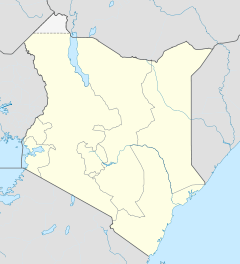

Mount Elgon District Politik Provinz Western Mount Elgon District ist ein Distrikt in der kenianischen Provinz Western. Die Hauptstadt ist Kapsokwony. Der Distrikt liegt südöstlich des Mount Elgon, im Norden und Westen grenzt er an Uganda.[2]
Inhaltsverzeichnis
Gliederung
Der Distrikt gliedert sich in vier Divisionen: Kapsokwony, Kaptama, Kopsiro und Cheptais. Diese sind in 16 Locations und 40 Sub-Locations unterteilt. Der Mount Elgon District bildet einen Wahlbezirk.[2]
Divisionen[2] Division Einwohner Fläche in km² Kapsokwony 24.526 255,66 Kaptama 23.885 209,95 Kopsiro 46.553 248,78 Cheptais 40.069 222,36 Gesamt 135.003 936,75 Gesundheitswesen
Der Mount Elgon District verfügt über ein Krankenhaus, drei Gesundheitszentren und sechs Dispensaries. Auf einen Arzt kommen mehr als 144.000 Personen. 21 % der Bevölkerung im Mount Elgon District sind HIV-positiv oder an Aids erkrankt. Die Säuglingssterblichkeit liegt bei 6,36 %, den 5. Geburtstag erleben 9,4 % der Kinder nicht.[3]
Konflikt am Mount Elgon
Im Mai 2006 eskalierte der Konflikt zwischen den Angehörigen der Saboat, die zu den Kalenjin gehören, und der kenianischen Regierung. Die Saboat warfen der Regierung vor, ihr Land den verfeindeten Okiek zugesprochen zu haben. Die „Sabaot Land Defence Force“ kämpfte gegen die Okiek und die kenianische Armee. Im Mai 2008 wurde von mehr als 600 Toten und 400 Folteropfern berichtet.[4]
Einzelnachweise
- ↑ statoids.com, abgerufen am 26. Oktober 2010
- ↑ a b c District Strategic Plan 2005–2010 (pdf), S. 10; abgerufen am 26. Oktober 2010.
- ↑ District Strategic Plan 2005–2010 (pdf), S. 15; abgerufen am 26. Oktober 2010.
- ↑ Thilo Thielke: Der vergessene Krieg am Mount Elgon, Artikel vom 3. Mai 2008 auf spiegel.de, abgerufen am 26. Oktober 2010.
 Distrikte in Kenia
Central Province: Kiambu | Kirinyaga | Maragua | Murang’a | Nyandarua | Nyeri | Thika
Coast Province: Kilifi | Kwale | Lamu | Malindi | Mombasa | Taita-Taveta | Tana River
Eastern Province: Embu | Isiolo | Kitui | Machakos | Makueni | Marsabit | Mbeere | Meru Central | Meru North | Meru South | Moyale | Mwingi | Tharaka
North-Eastern Province: Garissa | Ijara | Wajir | Mandera
Nyanza Province: Bondo | Gucha | Homa Bay | Kisii Central | Kisumu | Kuria | Migori | Nyamira | Nyando | Rachuonyo | Siaya | Suba
Rift Valley Province: Baringo | Bomet | Buret | Kajiado | Keiyo | Kericho | Koibatek | Laikipia | Marakwet | Nakuru | Nandi | Narok | Samburu | Trans Mara | Trans-Nzoia | Turkana | Uasin Gishu | West Pokot
Western Province: Bungoma | Busia | Butere/Mumias | Kakamega | Lugari | Mount Elgon | Teso | Vihiga
Nairobi: Nairobi

Wikimedia Foundation.