- Embu District
-
Embu District Basisdaten Einwohner
- Bevölkerungsdichte296.992 Einw.
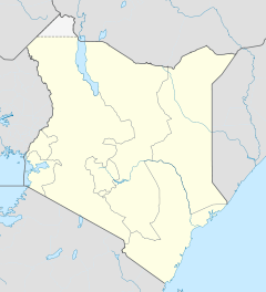
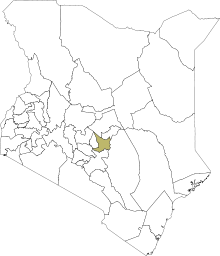
409 Einw./km²Fläche 725,5 km² Koordinaten 0° 32′ S, 37° 27′ O-0.5333333333333337.45Koordinaten: 0° 32′ S, 37° 27′ O Politik Provinz Eastern Der Embu District ist ein Bezirk in der Provinz Eastern in Kenia. Die Hauptstadt des Distrikts ist Embu. Im Distrikt lebten 2009 296.992 Menschen auf 725.5 km².[1] Der Distrikt ist in fünf Divisionen unterteilt: Central, Kyeni, Manyatta, Nembure und Runyenjes.[2] Das Klima ist semi-arid.[3]
Inhaltsverzeichnis
Topografie und Geologie
Der Bezirk liegt am Mount Kenya und den Aberdare Ranges, der Boden besteht daher aus Nitisol, Andosol, Vertisol, Ferrosol und Cambisol.[4]
Wirtschaft
Ungefähr 60 % der Bevölkerung im Embu District lebt von der Landwirtschaft, 56 % der Menschen leben dabei unterhalb der Armutsgrenze.[3] Hauptsächlich werden Mais, Mangos, Bohnen und Saubohnen, Papau, Kaffeebohnen, Avocado, Bananen, Baumwolle, Sonnenblumen, Mung- und Augenbohnen angebaut.[4]
Gesundheitswesen
Der Distrikt verfügt über fünf staatliche Krankenhäuser, drei Gesundheitszentren und über 80 privat geführte Kliniken. Auf einen Arzt kamen 2005 ungefähr 10.500 Patienten. Es werden hauptsächlich Malaria, Atemwegsinfektionen, Hautkrankheiten und Wurmbefall behandelt. Die HIV-Prävalenzrate liegt bei circa 26 %.[5] Die Säuglingssterblichkeit lag 2005 bei 5,6 %, 0,6 % der Kinder sterben vor ihrem 5. Geburtstag.[6]
Einzelnachweise
- ↑ Kenya National Bureau of Statistics, 2010: The 2009 Kenya Population and Housing Census.
- ↑ Embu District Strategic Plan 2005–2010, S. 10; abgerufen am 2. Mai 2011.
- ↑ a b Embu District Strategic Plan 2005–2010, S. 14; abgerufen am 2. Mai 2011.
- ↑ a b James O. Ouma, Festus M. Murithi, Wilfred Mwangi, Hugo Verkuijl u. a.:Adoption of Maize Seed and Fertilizer Technologies in Embu District, Kenya, S. 3; hier online bei books.google, abgerufen am 2. Mai 2011.
- ↑ Embu District Strategic Plan 2005–2010, S. 15; abgerufen am 2. Mai 2011.
- ↑ Embu District Strategic Plan 2005–2010, S. 16; abgerufen am 2. Mai 2011.
Distrikte in KeniaCentral Province: Kiambu | Kirinyaga | Maragua | Murang’a | Nyandarua | Nyeri | Thika
Coast Province: Kilifi | Kwale | Lamu | Malindi | Mombasa | Taita-Taveta | Tana River
Eastern Province: Embu | Isiolo | Kitui | Machakos | Makueni | Marsabit | Mbeere | Meru Central | Meru North | Meru South | Moyale | Mwingi | Tharaka
North-Eastern Province: Garissa | Ijara | Wajir | Mandera
Nyanza Province: Bondo | Gucha | Homa Bay | Kisii Central | Kisumu | Kuria | Migori | Nyamira | Nyando | Rachuonyo | Siaya | Suba
Rift Valley Province: Baringo | Bomet | Buret | Kajiado | Keiyo | Kericho | Koibatek | Laikipia | Marakwet | Nakuru | Nandi | Narok | Samburu | Trans Mara | Trans-Nzoia | Turkana | Uasin Gishu | West Pokot
Western Province: Bungoma | Busia | Butere/Mumias | Kakamega | Lugari | Mount Elgon | Teso | Vihiga
Nairobi: Nairobi
Wikimedia Foundation.
Schlagen Sie auch in anderen Wörterbüchern nach:
Embu District — is an administrative district in the Eastern Province of Kenya. Its capital town is Embu. The district has a population of 278,196 [http://treasury.go.ke/cbs.go.ke/pdf/authority.pdf] The district has two constituencies: Manyatta and Runyenjes.… … Wikipedia
Embu, Kenya — Embu is a large town in Kenya, located approximately 120 kilometers (75 miles) northeast of Nairobi towards Mount Kenya. Embu serves as the provincial headquarters of Eastern Province in Kenya and is also the district headquarters of Embu… … Wikipedia
Embu (ville) — Embu (Kenya) 0° 32′ 00″ S 37° 27′ 00″ E / 0.533333, 37.45 … Wikipédia en Français
Embu — heißen: eine Stadt in Brasilien, auch Embu das Artes genannt, siehe Embu (Brasilien) eine weitere Stadt in Brasilien in umbittelbarer Nähe der vorgenannten, siehe Embu Guaçu eine Stadt in Kenia, siehe Embu (Kenia) ein kenianischer… … Deutsch Wikipedia
Embu people — The Embu inhabit Embu District in Kenya. To the south of Embu are to be found their cousins, the Mbeere people, in Mbeere District. Previously, the Embu and Mbeere were in one district, Embu District, and just referred to as the Embu people. To… … Wikipedia
Embu (Kenya) — Pour les articles homonymes, voir Embu (homonymie). Embu Administration Pays … Wikipédia en Français
Embu (tribu) — Embus Pour les articles homonymes, voir Embu (homonymie). Embus Populations significatives par régions … Wikipédia en Français
Mbeere District — Cumulative rainfall at Masinga dam, Kenya. Mbeere District is an administrative district in the Eastern Province of Kenya. Its capital town is Siakago. The district has a population of 170,950 and an area of 2,093 km².[1] … Wikipedia
Meru Central District — is one of the seventy one districts of Kenya, located in that country s Eastern Province. In 1992, it was split from the large Meru District, along with Meru North District, Meru South District, and Tharaka District. Meru Central District is the… … Wikipedia
Meru North District — is one of the seventy one districts of Kenya, located in that country s Eastern Province. In 1992, it was split from the large Meru District, along with Meru Central District, Meru South District, and Tharaka District. Meru North District is the… … Wikipedia


