- Nakuru District
-
Nakuru District Basisdaten Einwohner
- Bevölkerungsdichte1.187.039 Einw. [1]
164 Einw./km²Fläche 7242 km² Koordinaten 0° 30′ S, 36° 0′ O-0.536Koordinaten: 0° 30′ S, 36° 0′ O 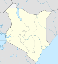

Nakuru District Politik Provinz Rift Valley Der Nakuru District ist ein Distrikt in der kenianischen Provinz Rift Valley. Die Hauptstadt des Distriktes ist Nakuru. Mit 1.187.039 Einwohnern (1999) ist er, gemessen an der Bevölkerung, nach Nairobi der zweitgrößte Distrikt des Landes. Der Nakuru District hat eine Fläche von 7242 km². Die Region ist landwirtschaftlich geprägt. Benachbarte Städte sind Lanet und Njoro. Lanet ist etwa 10 km entfernt und besteht hauptsächlich aus einem Wohngebiet und einem Militärstützpunkt. Das 20 km entfernte Njoro ist eine Kleinstadt mit einer landwirtschaftlichen Hochschule. Zu den Sehenswürdigkeiten zählen der Nakurusee im Lake-Nakuru-Nationalpark sowie der Menengai-Krater, ein erloschener Vulkan, der 2.490 m hoch ist.
Einzelnachweise
- ↑ statoids.com – Districts of Kenya (englisch)
 Distrikte in Kenia
Central Province: Kiambu | Kirinyaga | Maragua | Murang’a | Nyandarua | Nyeri | Thika
Coast Province: Kilifi | Kwale | Lamu | Malindi | Mombasa | Taita-Taveta | Tana River
Eastern Province: Embu | Isiolo | Kitui | Machakos | Makueni | Marsabit | Mbeere | Meru Central | Meru North | Meru South | Moyale | Mwingi | Tharaka
North-Eastern Province: Garissa | Ijara | Wajir | Mandera
Nyanza Province: Bondo | Gucha | Homa Bay | Kisii Central | Kisumu | Kuria | Migori | Nyamira | Nyando | Rachuonyo | Siaya | Suba
Rift Valley Province: Baringo | Bomet | Buret | Kajiado | Keiyo | Kericho | Koibatek | Laikipia | Marakwet | Nakuru | Nandi | Narok | Samburu | Trans Mara | Trans-Nzoia | Turkana | Uasin Gishu | West Pokot
Western Province: Bungoma | Busia | Butere/Mumias | Kakamega | Lugari | Mount Elgon | Teso | Vihiga
Nairobi: Nairobi

Wikimedia Foundation.