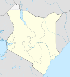
- Isiolo District
-
Isiolo District Basisdaten Einwohner
- Bevölkerungsdichte100.861 Einw.
4 Einw./km²Fläche 25.698 km² Koordinaten 0° 53′ N, 38° 40′ O0.8833333333333338.666666666667Koordinaten: 0° 53′ N, 38° 40′ O Politik Provinz Eastern Der Distrikt Isiolo ist ein Bezirk in der Provinz Eastern in Kenia. Die Hauptstadt des Distrikts ist Isiolo. Im Distrikt lebten 1999 100.861 Menschen auf 25.698 km².[1] 12,5 % der Haushalte sind an das Stromnetz angeschlossen.[2] Durch den Distrikt fließt der Uaso Nyiro.
Gliederung
Der Distrikt teilt sich in sechs Divisionen und zwei Wahlbezirke, Isiolo North und Isiolo South, auf.
Divisionen Division Einwohner[2] Hauptstadt Central 52.280 Isiolo Garba Tula 7.010 Garba Tula Kinna 7.133 Kinna Merti 15.771 Merti Oldonyiro 9.669 Sericho 8.998 Gesamt 100.861 - Religion
Der Distrikt Isiolo gehört zum Apostolischen Vikariat der römisch-katholischen Kirche. Neben mehreren Primary und Secondary Schools unterhält die katholische Kirche im Distrikt Isiolo Kinderheime, medizinische Ambulanzen, eine Krankenpflegeschule und eine Fachhochschule. 27.000 Katholiken leben im Distrikt Isiolo.[3]
Einzelnachweise
- ↑ statoids.com – Districts of Kenya, abgerufen am 13. Dezember 2009.
- ↑ a b Statistik auf cck.go.ke (pdf), abgerufen am 13. Dezember 2009.
- ↑ Apostolisches Vikariat Isiolo auf der Homepage der Kenya Episcopal Conference, abgerufen am 13. Dezember 2009.
Distrikte in KeniaCentral Province: Kiambu | Kirinyaga | Maragua | Murang’a | Nyandarua | Nyeri | Thika
Coast Province: Kilifi | Kwale | Lamu | Malindi | Mombasa | Taita-Taveta | Tana River
Eastern Province: Embu | Isiolo | Kitui | Machakos | Makueni | Marsabit | Mbeere | Meru Central | Meru North | Meru South | Moyale | Mwingi | Tharaka
North-Eastern Province: Garissa | Ijara | Wajir | Mandera
Nyanza Province: Bondo | Gucha | Homa Bay | Kisii Central | Kisumu | Kuria | Migori | Nyamira | Nyando | Rachuonyo | Siaya | Suba
Rift Valley Province: Baringo | Bomet | Buret | Kajiado | Keiyo | Kericho | Koibatek | Laikipia | Marakwet | Nakuru | Nandi | Narok | Samburu | Trans Mara | Trans-Nzoia | Turkana | Uasin Gishu | West Pokot
Western Province: Bungoma | Busia | Butere/Mumias | Kakamega | Lugari | Mount Elgon | Teso | Vihiga
Nairobi: Nairobi
Wikimedia Foundation.

