- Meru South District
-
Meru South District Basisdaten Einwohner
- Bevölkerungsdichte205.451 Einw.
188 Einw./km²Fläche 1093 km² Koordinaten 0° 19′ S, 37° 38′ O-0.3166666666666737.633333333333Koordinaten: 0° 19′ S, 37° 38′ O 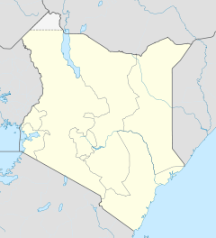

Meru South District Politik Provinz Eastern  Lage des Meru South Districts in Kenia
Der Meru South District ist ein Bezirk in der Provinz Eastern in Kenia. Die Hauptstadt ist Chuka. Im Distrikt lebten 1999 205.451 Menschen auf 1.093 km².[1] Meru South District ist in die fünf Divisionen Mwimbi, Muthambi, Chuka, Magumoni und Igamba Ng’ombe aufgeteilt. Bis 1997 gehörte das Gebiet zum damaligen Tharaka Nithi District.[2] Im Jahr 2000 lebten 72 % der Einwohner unterhalb der Armutsgrenze.[3]
Inhaltsverzeichnis
Topografie und Geologie
Der Meru South District erstreckt sich über vom Mount-Kenya-Massiv mit 5200 m über dem Meeresspiegel bis ins Flachland, das noch 600 m über dem Meeresspiegel liegt.[4] Durch den Bezirk fließen die Flüsse Thuchi, Ruguti, Tungu, Nithi, South Mara, North Mara und Mutonga, die alle in den Tana münden.[4][5] Die Böden im Hochland sind größtenteils vulkanischen Ursprungs. Die Hügelketten bieten vor allem Nitisol und Andosol, im Flachland findet man hauptsächlich Cambisol und Regosol.[6]
Wirtschaft
Auf dem roten Lehmboden[4] im District werden vor allem Kaffeebohnen und Tee angebaut. Die Viehzucht konzentriert sich auf Milchvieh.[3] Für den Eigenbedarf werden hauptsächlich Mais, Bohnen, Hirse, Sorghum und Saubohnen angepflanzt.[7]
An den permanent wasserführenden Flüssen hat sich eine kleine Fischfangindustrie etabliert. Diese konzentriert sich auf den Fang von Afrikanischen Raubwelsen, Forellen, Karpfen und Tilapia.[8]
Gesundheitswesen
Den Einwohnern standen im Jahr 2007 insgesamt 54 Einrichtungen des Gesundheitswesens zur Verfügung, davon fünf Krankenhäuser. Auf einen Arzt kamen im Jahr 2004 1300 Patienten.[9] Die häufigsten Erkrankungen im Meru South District sind Atemwegsinfektionen, Wurmerkrankungen und Malaria.[10] Die HIV-Prävalenzrate lag im Jahr 2007 bei 30 %.[11] Statistische Erhebungen im Jahr 2004 ergaben eine Kindersterblichkeit im Meru South District von 7,64 %, die Neugeborenensterblichkeit lag bei 14,3 %, während 8,7 % der Kinder noch vor ihrem 5. Geburtstag verstarben. Die Müttersterblichkeit wurde mit 12,4 % beziffert.[9]
Infrastruktur
Im Meru South District gab es im Jahr 2007 nur eine geteerte Straße, die knapp 35 km lange B6 von Thuci nach Nkubu.[12] Fünf Postämter und 86 Telefonzellen sind über den Bezirk verteilt. 2007 verfügten 764 private Haushalte über einen Telefonanschluss.[5] Mit jeweils einer Zweigstelle der Co-operative Bank of Kenya, der Equity Bank und der Kenya Commercial Bank standen den Einwohnern im Jahr 2007 drei Bankfilialen zur Verfügung.[13] Im Jahr 1999 waren 900 Haushalte an die Stromversorgung angeschlossen, 94 % der Einwohner gewinnen die benötigte Energie aus Holz und Kohle. 2007 verfügte der Distrikt über zwei kleine Wasserkraftwerke zur Stromerzeugung.[14]
Im Jahr 2007 verfügte der Distrikt über 272 Vorschuleinrichtungen, 230 Primary Schools, 70 Secondary Schools und fünf Einrichtungen der Höheren Bildung. Die Einschulungsrate lag bei 83 %.[9]
Tourismus
Die Tourismusindustrie ist auf Bergsteiger und Ökotouristen am Mount-Kenya-Massiv konzentriert. 2005 gab es drei Touristenhotels im Distrikt.[15]
Fauna
Neben Elefanten, Leoparden, Riesenwaldschweinen und Zebras leben vor allem im Mount Kenya Forest Steinböckchen, Buschböcke, Bergriedböcke, Pinselohrschweine, Elenantilopen, Weißkehlmeerkatzen, Schwarz-weiße Stummelaffen und Anubispaviane.[16] Selten gewordene Tiere im Meru South District sind Bongos und Spitzmaulnashörner. Als gefährdet gilt die Elefantenpopulation.[17]
Einzelnachweise
- ↑ statoids.com, abgerufen am 1. Juli 2011.
- ↑ District Environment Action Plan 2006-2011, unpei.org, S. 10; abgerufen am 1. Juli 2011.
- ↑ a b District Environment Action Plan 2006-2011, unpei.org, S. 14; abgerufen am 1. Juli 2011.
- ↑ a b c District Environment Action Plan 2006-2011, unpei.org, S. 12; abgerufen am 1. Juli 2011.
- ↑ a b District Environment Action Plan 2006-2011, unpei.org, S. 25; abgerufen am 1. Juli 2011.
- ↑ District Environment Action Plan 2006-2011, unpei.org, S. 31; abgerufen am 1. Juli 2011.
- ↑ District Environment Action Plan 2006-2011, unpei.org, S. 37; abgerufen am 1. Juli 2011.
- ↑ District Environment Action Plan 2006-2011, unpei.org, S. 42; abgerufen am 1. Juli 2011.
- ↑ a b c District Environment Action Plan 2006-2011, unpei.org, S. 27; abgerufen am 1. Juli 2011.
- ↑ District Environment Action Plan 2006-2011, unpei.org, S. 20/21; abgerufen am 1. Juli 2011.
- ↑ District Environment Action Plan 2006-2011, unpei.org, S. 8; abgerufen am 1. Juli 2011.
- ↑ District Environment Action Plan 2006-2011, unpei.org, S. 24; abgerufen am 1. Juli 2011.
- ↑ District Environment Action Plan 2006-2011, unpei.org, S. 7; abgerufen am 1. Juli 2011.
- ↑ District Environment Action Plan 2006-2011, unpei.org, S. 26; abgerufen am 1. Juli 2011.
- ↑ District Environment Action Plan 2006-2011, unpei.org, S. 66; abgerufen am 1. Juli 2011.
- ↑ District Environment Action Plan 2006-2011, unpei.org, S. 56; abgerufen am 1. Juli 2011.
- ↑ District Environment Action Plan 2006-2011, unpei.org, S. 59; abgerufen am 1. Juli 2011.
 Distrikte in Kenia
Central Province: Kiambu | Kirinyaga | Maragua | Murang’a | Nyandarua | Nyeri | Thika
Coast Province: Kilifi | Kwale | Lamu | Malindi | Mombasa | Taita-Taveta | Tana River
Eastern Province: Embu | Isiolo | Kitui | Machakos | Makueni | Marsabit | Mbeere | Meru Central | Meru North | Meru South | Moyale | Mwingi | Tharaka
North-Eastern Province: Garissa | Ijara | Wajir | Mandera
Nyanza Province: Bondo | Gucha | Homa Bay | Kisii Central | Kisumu | Kuria | Migori | Nyamira | Nyando | Rachuonyo | Siaya | Suba
Rift Valley Province: Baringo | Bomet | Buret | Kajiado | Keiyo | Kericho | Koibatek | Laikipia | Marakwet | Nakuru | Nandi | Narok | Samburu | Trans Mara | Trans-Nzoia | Turkana | Uasin Gishu | West Pokot
Western Province: Bungoma | Busia | Butere/Mumias | Kakamega | Lugari | Mount Elgon | Teso | Vihiga
Nairobi: Nairobi


Wikimedia Foundation.