- Teso District
-
Teso District Basisdaten Einwohner
- Bevölkerungsdichte181.491 Einw. [1]
325 Einw./km²Fläche 559 km² Koordinaten 0° 37′ N, 34° 16′ O0.6166666666666734.266666666667Koordinaten: 0° 37′ N, 34° 16′ O 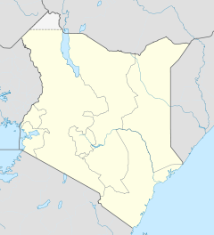

Teso District Politik Provinz Western Teso District ist ein Distrikt in der kenianischen Provinz Western. Die Hauptstadt ist Malaba. Im Westen grenzt der Distrikt an Uganda.
Inhaltsverzeichnis
Gliederung
Teso District unterteilt sich in vier Divisionen, die sich in 30 Locations und 82 Sub-Locations unterteilen.[2]
Divisionen[2] Division Einwohner Fläche in km² Amagoro 36.670 91,2 Amukura 52.287 181,8 Angurai 48.648 145,6 Chakol 59.780 139,9 Gesamt 197.395 558,5 Wirtschaft
Im Jahr 2002 lebten 56 Prozent der Einwohner im Teso District unterhalb der Armutsgrenze und verdienten weniger als einen US-Dollar am Tag. 65 Prozent der Menschen leben von der Landwirtschaft, es werden hauptsächlich Mais, Bohnen, Hirse, Tabak, Kaffee, Baumwolle und Zuckerrohr angebaut. Im Distrikt fehlt es an Industrie.[3]
Gesundheitswesen
Im Teso District gibt es 13 staatliche Einrichtungen des Gesundheitswesens. Hauptsächlich werden Malaria, Atemwegsinfektionen und Krankheiten des Verdauungsapparates behandelt. Das Arzt-Patienten-Verhältnis beträgt 1:45.372. Die Säuglingssterblichkeit liegt bei 7,5 Prozent, den fünften Geburtstag erlebt jedes elfte Kind nicht. Ungefähr jeder vierte Einwohner im Teso District ist HIV-positiv oder an Aids erkrankt, der Distrikt hat damit eine der höchsten HIV-Prävalenzraten in Kenia. Die Gründe dafür werden mit der ständig steigenden Anzahl von Waisenkindern angegeben und dem damit verbundenen Anstieg von Kinderprostitution und Kinderarbeit bei gleichzeitig sinkenden landwirtschaftlichen Erträgen.[4]
Einzelnachweise
- ↑ statoids.com, abgerufen am 27. Oktober 2010
- ↑ a b District Strategic Plan 2005–2010 (pdf), S. 10; abgerufen am 27. Oktober 2010.
- ↑ District Strategic Plan 2005–2010 (pdf), S. 17; abgerufen am 27. Oktober 2010.
- ↑ District Strategic Plan 2005–2010 (pdf), S. 15/16; abgerufen am 27. Oktober 2010.
 Distrikte in Kenia
Central Province: Kiambu | Kirinyaga | Maragua | Murang’a | Nyandarua | Nyeri | Thika
Coast Province: Kilifi | Kwale | Lamu | Malindi | Mombasa | Taita-Taveta | Tana River
Eastern Province: Embu | Isiolo | Kitui | Machakos | Makueni | Marsabit | Mbeere | Meru Central | Meru North | Meru South | Moyale | Mwingi | Tharaka
North-Eastern Province: Garissa | Ijara | Wajir | Mandera
Nyanza Province: Bondo | Gucha | Homa Bay | Kisii Central | Kisumu | Kuria | Migori | Nyamira | Nyando | Rachuonyo | Siaya | Suba
Rift Valley Province: Baringo | Bomet | Buret | Kajiado | Keiyo | Kericho | Koibatek | Laikipia | Marakwet | Nakuru | Nandi | Narok | Samburu | Trans Mara | Trans-Nzoia | Turkana | Uasin Gishu | West Pokot
Western Province: Bungoma | Busia | Butere/Mumias | Kakamega | Lugari | Mount Elgon | Teso | Vihiga
Nairobi: Nairobi

Wikimedia Foundation.