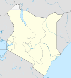
- Kajiado District
-
Kajiado District Basisdaten Einwohner
- Bevölkerungsdichte640.593 Einw.
29 Einw./km²Fläche 21.903 km² Koordinaten 2° 0′ S, 36° 52′ O-236.866666666667Koordinaten: 2° 0′ S, 36° 52′ O Politik Provinz Rift Valley Kajiado District ist ein Distrikt in der kenianischen Provinz Rift Valley. Die Hauptstadt des Distriktes ist Kajiado. Im Distrikt lebten 2005 640.593 Menschen auf 21.903 km².[1]
Der Distrikt grenzt im Südwesten an Tansania, im Nordosten an Nairobi. Die meisten Menschen im Kajiado District gehören zu den Maasai und leben als Halbnomaden von der Viehhaltung. Die Region gilt als Halbwüste, nur knapp 8 % der Landfläche sind urbar.[1] Mit drei ständig wasserführenden Flüssen ist die Wasserversorgung der Distriktes ein Problem. 28 % der Haushalte verfügen über einen Trinkwasseranschluß.[1]
Gliederung
Der Distrikt teilt sich in Divisionen auf. Es gibt drei Wahlbezirke, Kajiado Nord, Kajiado Süd und Kajiado Central.
Divisionen Division Einwohner (1999)[2] Hauptstadt Central 69.402 Kajiado Loitokitok 95.430 Magadi 20.112 Magadi Mashuru 35.666 Mashuru Namanga 35.673 Namanga Ngong 149.771 Ngong Gesamt 406.054 - Sehenswürdigkeiten
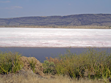
Im Kajiado District befinden sich der Amboseli-Nationalpark, die Nyeri-Wüste und der Magadisee.
Einzelnachweise
- ↑ a b c kenyafoodsecurity.org (pdf), abgerufen am 12. Februar 2010.
- ↑ Statistik auf cck.go.ke, abgerufen am 12. Februar 2010.
Distrikte in KeniaCentral Province: Kiambu | Kirinyaga | Maragua | Murang’a | Nyandarua | Nyeri | Thika
Coast Province: Kilifi | Kwale | Lamu | Malindi | Mombasa | Taita-Taveta | Tana River
Eastern Province: Embu | Isiolo | Kitui | Machakos | Makueni | Marsabit | Mbeere | Meru Central | Meru North | Meru South | Moyale | Mwingi | Tharaka
North-Eastern Province: Garissa | Ijara | Wajir | Mandera
Nyanza Province: Bondo | Gucha | Homa Bay | Kisii Central | Kisumu | Kuria | Migori | Nyamira | Nyando | Rachuonyo | Siaya | Suba
Rift Valley Province: Baringo | Bomet | Buret | Kajiado | Keiyo | Kericho | Koibatek | Laikipia | Marakwet | Nakuru | Nandi | Narok | Samburu | Trans Mara | Trans-Nzoia | Turkana | Uasin Gishu | West Pokot
Western Province: Bungoma | Busia | Butere/Mumias | Kakamega | Lugari | Mount Elgon | Teso | Vihiga
Nairobi: Nairobi
Wikimedia Foundation.
Schlagen Sie auch in anderen Wörterbüchern nach:
Kajiado District — is an administrative district in the Rift Valley Province of Kenya. It has a population of 406.054 and an area of 21,903 km² [http://www.statoids.com/yke.html] . The district borders Nairobi city and extends to the Kenya Tanzania border further… … Wikipedia
Kajiado — is a town in the Rift Valley Province, Kenya. The town is located south of Nairobi, along the Nairobi – Arusha highway. Kajiado has an urban population of 8128 (1999 census) [http://treasury.go.ke/cbs.go.ke/pdf/authority.pdf] . Local people are… … Wikipedia
Kajiado North Constituency — is an electoral constituency in Kenya. It is one of three constituencies in Kajiado District. The constituency was established for the 1966 elections. The entire area of the constituency is located in Olkejuado county council.Former vice… … Wikipedia
Mombasa District — District … Wikipedia
Mbeere District — Cumulative rainfall at Masinga dam, Kenya. Mbeere District is an administrative district in the Eastern Province of Kenya. Its capital town is Siakago. The district has a population of 170,950 and an area of 2,093 km².[1] … Wikipedia
Nyando District — is a fairly new district in Kenya which broke away from Kisumu District in Nyanza Province in 1998. Nyando district borders the Rift Valley Province. The district is named after the Nyando River. Its capital is in a small town called Awasi,… … Wikipedia
Nyandarua District — is an administrative district in the Central Province of Kenya. Its capital town is Ol Kalou. Formerly the capital was Nyahururu, but it is now part of the Laikipia District. Nyandarua District has population of 479,902 and an area of 3,304 km²… … Wikipedia
Mount Elgon District — (Mt. Elgon District) is an administrative district in the Western Province of Kenya. Its capital town is Kapsokwony. Contents 1 Geography and demographics 2 Government 3 Parliamentary representation … Wikipedia
Meru Central District — is one of the seventy one districts of Kenya, located in that country s Eastern Province. In 1992, it was split from the large Meru District, along with Meru North District, Meru South District, and Tharaka District. Meru Central District is the… … Wikipedia
Narok District — is an administrative district in Kenya. The Narok District is located in the Rift Valley Province, and has a population of 365,750. Its capital town is Narok. Along with Kisii District, Narok District has been identified as having the highest… … Wikipedia